![]() Trip Diary
2002
Trip Diary
2002
First a few events that preceded the start of the trip.
August 2001:
I was cruising along one of the California's famous beaches when the thought occurs to me that I have always wanted to travel the states on a bike, why not now? A plan starts to formulate. It will take two, maybe three weeks to go from coast to coast and back.
December 2001:
My wife and son get included in the plans for the trip as it gets expanded to four weeks.
January 2002:
We schedule the time off work and try to figure a route across the states in a way that allows us to visit friends and family along the way, and still share two bikes with three drivers.
February 2002:
The plan starts to shape up with my wife starting the trip and switching with my son on the other side of the country. Maybe in Florida.
March 2002:
Karen and I are planning to take the middle to lower states on the way across, while Cory and I are planning the return trip across the northern states.
April 2002:
Trying to visit with (all) the relatives and still get across the states in four weeks is just putting too much into too little time, so we change the plan to 5 weeks. Three to get across with Cory and I making a swift trip across the top in two weeks.
May 2002:
My son decides that trying to make a trip like this is more that he wants to attempt the first time out, especially with so little time to make it. Now Karen and I have to decide if we can both do the full five weeks.
June 2002:
The trip is on. We plan the first half with plenty of room to adjust. We get the bikes ready, get the gear ready, get ourselves mentally prepared. We are actually going to do this.
************************************************************************
Actual trip diary as we upload this to the web site at the end of each day.
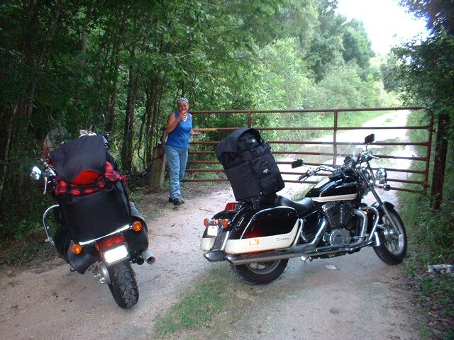
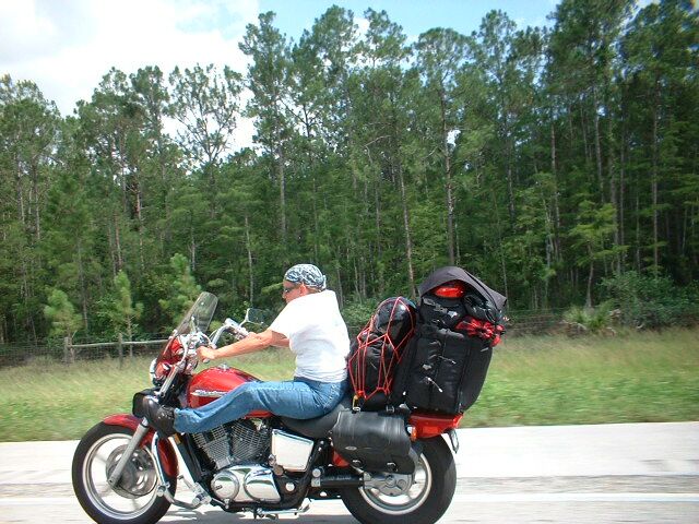
We left Anaheim without incident and got underway more or less as expected. It seemed it might be a little cooler than we expected, but that soon proved to be incorrect. As we made our way to Las Vegas, the temperature went from about 65 all the way up to 108. We made it to Vegas about 6 minutes ahead of schedule, but then visited with some old friends longer than we had planned. Then to make sure we were late leaving Vegas, we stopped at the “Largest Harley Dealer in the world” to do some shopping. Jumping on the freeway only to realize it was the wrong one, put us on the correct road about 2 hours later than we had planned. Now in the worst heat of the day we crossed the last part of the Mojave Desert. We knew how hot it was, but did not pay as much attention as we should have to our water consumption. Just before the off-ramp at the Moapa exit, Karen flew past me in a big hurry and took the exit. Fortunately there was a hidden treasure called Grub & Groceries just off the exit. She pulled into the parking lot, stopped and removed her helmet. She turned bright red almost immediately. As it turned out, she had managed to find that illusive thing they call heat stroke. The woman at the store fortunately knew exactly what was wrong and started Karen on a lot of cool water. We lost a couple of hours and I started wondering if our trip had ended almost after it started. Since we took the time in the shade and got her water level back to where it should be though, we were able to continue. After that we paid very close attention to our hydration. A lesson well learned before anyone attempts a trip like this one. Crossing through the corner of Arizona and into Utah, it finally started to cool a little. We arrived at our destination of Cedar City, Utah before dark, which was our ultimate goal for day one. The highways were good most of the way with some new construction going on south of Las Vegas where they are widening the road. Traffic was also much lighter than we had expected.
We had planned another early departure, but we had forgotten about the time change and I had spent too many hours the night before trying to access the web without success. As a result we left about an hour and a half after we had planned to. We only stopped in Cedar City once, and that was to take some pictures. Then it was northbound up the 15 and eastbound on the 70. Although it was another hot day, it was a much more picturesque trip. The valley up through Beaver was beautiful working farms and the watering systems made them look like fountains in the morning sun. Turning east on the 70 we started climbing, but when we crested the summit, it almost took my breath away. I just starred for the first few minutes until I finally realized I should take a few pictures. Once we dropped a couple thousand feet, we were back in the desert again. This was a much different kind of place looking more like the Grand Canyon. The rock formations looked to me like something giant kids had carved out of stone to play with. We stopped in Richfield to get gas, then about 120 more miles of this kind of terrain. It was kind of windy and the heat made us feel like we were in front of a hair dryer for the next 3 hours. Finally arriving at Green River we knew the worst was over. Another 100 miles and we crossed over into Colorado. It was like we went through a time warp. We came up over this hill, saw the Colorado sign, took a picture, then turned the corner and there was green. Trees, grasses , water, and people. As we wound our way along the river the temperature dropped about 10 to 15 degrees and we arrived at Grand Junction just missing the Country Jam. We made a mistake when we turned off of the interstate to go through the city. I'd suggest if you make this trip, stay on the freeway. Anyway we are here for the night, so until tomorrow, have a good night.
July 2002:
Leaving the beauty of Grand
Junction behind us, we started over the mountain. As we started riding through
the canyon I realized for the first time why the word majestic must have been
created. I don’t think you can truly understand the meaning of the word unless
you have ridden through here on a bike. To
be out here on a warm day feeling the cool breeze blowing off the water with the
smell of the forest in your face as you wind your way along the river, is one if
the most pleasant things that can happen to a rider.
Stopping several times as we see ski 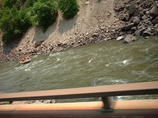 lodges in their summer mode, watch
the rafters brave the white water, and the bicyclers ride the special mountain
path made for just that purpose, you get a sense of the spirit of the people
that reside here. As we rode on
over the top, or actually through the tunnel, of Loveland pass and head down the
6% downgrade, I realize that our 1100 Shadows had not even felt the climb over
these high mountains while nearly ever vehicle was straining to get up the hill.
A few more miles of this beauty and we were rewarded with one of the most
unusual sites, the fires burning up this part of Colorado.
We were not allowed to stop as we watched the helicopter scoop water from
the river and drop it on the completely unreachable parts of the fire. It looked
to me like one of the smaller fires and I think they had it about out, but it
sure burned home the reason for all the no fireworks signs we had passed. Another 30 miles of this wonder, and we came down the hill
into Denver. We’ll stop and see some friends here before heading north.
Until tomorrow….
lodges in their summer mode, watch
the rafters brave the white water, and the bicyclers ride the special mountain
path made for just that purpose, you get a sense of the spirit of the people
that reside here. As we rode on
over the top, or actually through the tunnel, of Loveland pass and head down the
6% downgrade, I realize that our 1100 Shadows had not even felt the climb over
these high mountains while nearly ever vehicle was straining to get up the hill.
A few more miles of this beauty and we were rewarded with one of the most
unusual sites, the fires burning up this part of Colorado.
We were not allowed to stop as we watched the helicopter scoop water from
the river and drop it on the completely unreachable parts of the fire. It looked
to me like one of the smaller fires and I think they had it about out, but it
sure burned home the reason for all the no fireworks signs we had passed. Another 30 miles of this wonder, and we came down the hill
into Denver. We’ll stop and see some friends here before heading north.
Until tomorrow….
Today
was a lazy day. We slept in, talked with our friends and had a late breakfast
around noon. We packed our stuff, loaded up, and said goodbye to some of the
best people anyone can call friends. If there is one place on this trip I
would like to have spent more time, this is it. This trip however is about
seeing more of this country, so spending time with good friends will have to
wait for another time. After taking some of the side roads from the north
eastern part of Denver, we found ourselves heading north on the I-25. I was
surprised by how many bikes we saw on this short trip from Denver to Ft.
Collins. Besides passing the Budweiser plant, and four or five motorcycle
dealerships, the countryside boasted the only place I've ever seen with mile
high mountains to the left and flat land as far as the eye can see on the
right. When we arrived in Ft. Collins I was as amazed by the growth here
as I have been by the growth in most of the areas I've seen before. I still think of
this town as the little college town between Denver and Cheyenne, but it is just
not that small anymore. We drove down College avenue which appeared to be the
main street in town and found a nice little spot on the shady tree lined
street. I made a call to the president of the Ft. Collins chapter of our
riding club and we met him and another member of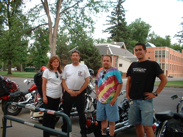 the club at a nice little place
called the Pickle Barrel. Besides good food and good conversation there was a
lot of very nice scenery that some of our young single members would have
appreciated. After we said goodbye to some new friends, we headed down the main
street again to check out the old part of the city, appropriately called Old
Town. Unlike most older parts of cities, this place was well maintained
and a very pleasant part of town. We then headed north again on the I-25 through
the northern part of Colorado. This part of the countryside was very much
like that before Ft.Collins with less population and a very noticeable aroma of
fertilizer in the fields. We did see a rainbow in the eastern sky that
seemed out of place. It just hung there in the sky for several miles, with absolutely
no sign of rain, or any other kind of moisture anywhere. I finally stopped and
took a picture. We arrived in Cheyenne and checked into a Comfort Inn on
the outskirts of Cheyenne. I mention this place because of the people here that truly
went out of their way for us. We had only a couple hours to visit with my
"kid" cousin here, but it was a very nice visit. It's late and I
need to spend time with someone else now. Did I mention that today is my wife
and my 30th anniversary?
the club at a nice little place
called the Pickle Barrel. Besides good food and good conversation there was a
lot of very nice scenery that some of our young single members would have
appreciated. After we said goodbye to some new friends, we headed down the main
street again to check out the old part of the city, appropriately called Old
Town. Unlike most older parts of cities, this place was well maintained
and a very pleasant part of town. We then headed north again on the I-25 through
the northern part of Colorado. This part of the countryside was very much
like that before Ft.Collins with less population and a very noticeable aroma of
fertilizer in the fields. We did see a rainbow in the eastern sky that
seemed out of place. It just hung there in the sky for several miles, with absolutely
no sign of rain, or any other kind of moisture anywhere. I finally stopped and
took a picture. We arrived in Cheyenne and checked into a Comfort Inn on
the outskirts of Cheyenne. I mention this place because of the people here that truly
went out of their way for us. We had only a couple hours to visit with my
"kid" cousin here, but it was a very nice visit. It's late and I
need to spend time with someone else now. Did I mention that today is my wife
and my 30th anniversary?
We got a late start today, which I blame on celebrating too late last night, but Karen said I spent way too much time updating the web site. We pulled out of Cheyenne around 11:30 am and headed north again on I-25. We rode through Chugwater, Wheatland, and Glendo before turning east on 18. Reaching the city of Lusk, we turned north again and rode up to Newcastle. It was 6 pm when we got here and we had been leading a storm for several hours, so we decided to stop for the night. I took several pictures of the scenery, but it is all pretty much the same. I am sure the people of this equality state would disagree with that last statement, but I want them to know that I find what I saw to be very attractive. Unlike most places I have been, in this state it is common to see neighborhoods where the nearest neighbor is a half a mile or more away. Having been born and raised in Cheyenne and Laramie, I feel like I am back home here, but I do not miss the wind. It is a beautiful night out, but I can see lightning in the distance, so I am not sure what to expect with the weather tomorrow. I will not be uploading this to the web until another stop because there is no data port to connect to in this location. I will have it ready to upload when I get the chance. Until then…..
 We started this morning early by greeting the
ducks by the pond outside our hotel room. The place we stayed was beautiful but
not what I would call customer friendly.
Leaving Newcastle and heading northeast up the 85 we see quite a change in
scenery. After
having driven through prairie most of yesterday, starting this day with trees,
lots of trees and gently curving roads and rolling hills.
We passed through several small towns, stopping in a few to get gas. This
was the most dangerous traffic we have seen yet, and that was only in the
station itself.
Once we left the station, just empty roads.
We didn’t see
many cars after that, considering this is the 4th of July I would
have expected more. On the other hand we had heard about a fire that we had just
missed from the day before and we saw a water-dropping helicopter just outside
of Deadwood and were detoured around highway 14.
That makes 3 fires we have been extremely close to since we left
California. I guess I can’t blame people for staying home.
When we finally did make it to Sturgis, we stopped at a local shop and
picked up those required mementos, drove through the town and back to freeway,
and on to Rapid City. We thought we had been in some wind the previous day going
through Wyoming, but the cross wind hitting us in South Dakota was worse by far.
Once we got to Rapid City, we decided it would better to stay this night even
though it put us a day behind. After we checked into the Quality Inn, we went to
the restaurant that was suggested by the receptionist at the
We started this morning early by greeting the
ducks by the pond outside our hotel room. The place we stayed was beautiful but
not what I would call customer friendly.
Leaving Newcastle and heading northeast up the 85 we see quite a change in
scenery. After
having driven through prairie most of yesterday, starting this day with trees,
lots of trees and gently curving roads and rolling hills.
We passed through several small towns, stopping in a few to get gas. This
was the most dangerous traffic we have seen yet, and that was only in the
station itself.
Once we left the station, just empty roads.
We didn’t see
many cars after that, considering this is the 4th of July I would
have expected more. On the other hand we had heard about a fire that we had just
missed from the day before and we saw a water-dropping helicopter just outside
of Deadwood and were detoured around highway 14.
That makes 3 fires we have been extremely close to since we left
California. I guess I can’t blame people for staying home.
When we finally did make it to Sturgis, we stopped at a local shop and
picked up those required mementos, drove through the town and back to freeway,
and on to Rapid City. We thought we had been in some wind the previous day going
through Wyoming, but the cross wind hitting us in South Dakota was worse by far.
Once we got to Rapid City, we decided it would better to stay this night even
though it put us a day behind. After we checked into the Quality Inn, we went to
the restaurant that was suggested by the receptionist at the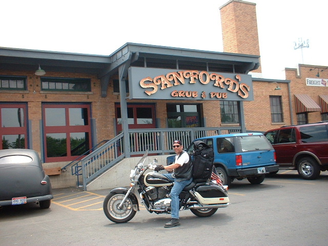 front desk.
Sanford’s Grub and Pub was a unique place. It was set up in an old factory and is supposed to be a junk
yard take off of the old Sanford & Son TV show.
The food was good and reasonable. We
decided to take a run down to see Mt. Rushmore today rather than wait until tomorrow. We got some pictures of the
famous heads and we even went down to
check out the new carving of Crazy Horse. The
pictures of the Indian did not come out because the camera was full. On the way
back we stopped in Keystone to do a little shopping and it started raining. The
bike got wet, but we were dry. On the way back to the motel, that all changed
with a sudden downpour. We got soaked. Still, by the time we got back, we were
dry. Hopefully the bad weather passed. Until tomorrow….
front desk.
Sanford’s Grub and Pub was a unique place. It was set up in an old factory and is supposed to be a junk
yard take off of the old Sanford & Son TV show.
The food was good and reasonable. We
decided to take a run down to see Mt. Rushmore today rather than wait until tomorrow. We got some pictures of the
famous heads and we even went down to
check out the new carving of Crazy Horse. The
pictures of the Indian did not come out because the camera was full. On the way
back we stopped in Keystone to do a little shopping and it started raining. The
bike got wet, but we were dry. On the way back to the motel, that all changed
with a sudden downpour. We got soaked. Still, by the time we got back, we were
dry. Hopefully the bad weather passed. Until tomorrow….
We left Rapid City this morning and went directly south on hwy
79. This allowed us to make up some
time with a fairly straight, yet picturesque, road for the next 50 miles until we
merged again with the 385 about 5 miles southeast of Hot Springs.
The many creeks that flowed through this area and across the road
intrigued me. I had never given much thought to how creeks are named until I
started reading these signs. Battle Creek, Beaver Creek, Lame Johnny Creek, Dry
Creek, Old Lady Creek, just to name a few. We stopped at a couple of the
historical sites and found that there was a lot of trapping and fur trading in
this area in the 1800’s, that explained many of the names.
The term “Black Hills” also came to life for me as we were driving
south in this area. If you looked to the right at the hills a few miles to the
west of us, these hills were coated with a dense layer of dark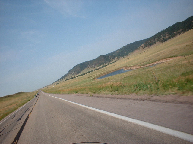 trees which at
this distance gave a black appearance as opposed to the green blue of the plains
leading up to them. Looking to the
east of us was just high plains as far as you could see. There is no way to
describe the “rolling hills of South Dakota” better, not that would do it
justice. If you want to appreciate it, you’ll just have to see it.
As we rode across the line into Nebraska, the only way you would know it,
is the state line casino and the obligatory “Welcome to Nebraska” sign. We
stopped and got a few pictures and
trees which at
this distance gave a black appearance as opposed to the green blue of the plains
leading up to them. Looking to the
east of us was just high plains as far as you could see. There is no way to
describe the “rolling hills of South Dakota” better, not that would do it
justice. If you want to appreciate it, you’ll just have to see it.
As we rode across the line into Nebraska, the only way you would know it,
is the state line casino and the obligatory “Welcome to Nebraska” sign. We
stopped and got a few pictures and 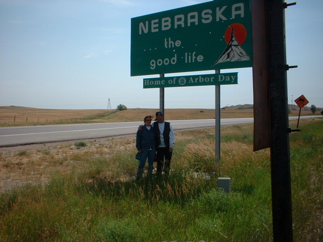 headed south again.
As we passed through the different counties of Nebraska, there was
nothing in particular that I could see that specifically said, “Nebraska”.
What I did notice was that this state had a little bit of most of the
states we had already been through. Parts
of it looked very much of South Dakota, Wyoming, Colorado, Utah, etc. There
seems to be a lot of farming and ranching, water, green, prairie, and let us not
forget the one thing my wife has reminded me of since we entered Wyoming, the
wind. If you only have time to see
one state and you want to get some of those “post card” type pictures,
Nebraska just might be the place. If
you are looking for rural cities, you’re in the wrong place.
As we continued southeast on the Nebraska “byway”, and passed through
towns with names like Alliance, Angora, Bridgeport, Broadwater, Oshkosh, an
Ogallala, we apparently just missed one of the best attractions in the area,
Lake McConaughy. I’m told the
lake has white sand as fine as any in the country and it is naturally here. The
lake however is not. We caught the I-80 at this point and then dropped south
again at North Platte. Another 35
miles brought us to a small road heading east into towns of Maywood, Curtis, and
Moorefield, our destination for today for a visit with my brother. I may not get to upload this tonight, but I’ll get it up as
soon as I can.
headed south again.
As we passed through the different counties of Nebraska, there was
nothing in particular that I could see that specifically said, “Nebraska”.
What I did notice was that this state had a little bit of most of the
states we had already been through. Parts
of it looked very much of South Dakota, Wyoming, Colorado, Utah, etc. There
seems to be a lot of farming and ranching, water, green, prairie, and let us not
forget the one thing my wife has reminded me of since we entered Wyoming, the
wind. If you only have time to see
one state and you want to get some of those “post card” type pictures,
Nebraska just might be the place. If
you are looking for rural cities, you’re in the wrong place.
As we continued southeast on the Nebraska “byway”, and passed through
towns with names like Alliance, Angora, Bridgeport, Broadwater, Oshkosh, an
Ogallala, we apparently just missed one of the best attractions in the area,
Lake McConaughy. I’m told the
lake has white sand as fine as any in the country and it is naturally here. The
lake however is not. We caught the I-80 at this point and then dropped south
again at North Platte. Another 35
miles brought us to a small road heading east into towns of Maywood, Curtis, and
Moorefield, our destination for today for a visit with my brother. I may not get to upload this tonight, but I’ll get it up as
soon as I can.
It is very hard to leave family that you haven’t seen in years. My brother and my dad live here and another of my brothers lives a couple hours from here. I had planned to leave early in the morning, but after sitting in the yard catching up until the late hours, even the local sheriff stopped by to have coffee and chat. My daughter had just gotten back from Hawaii and Mark (the sheriff) said he was going there on Monday. It just seems like the world keeps getting smaller. After he left, we covered the bikes and went inside, but as it always happens, we did not stop talking. I think we finally went to sleep about 2 in the morning. I guess I was more tired than I thought, because I slept until 9am and Karen was still asleep when I got up. By the time I ate something and got the majority of the bugs off my bike, it was well after noon. About the time we were deciding if we should take off, it started to rain. My brother had to work, and when he said he got off early, I decided to stay one more night. I will leave early in the morning. This will give me a little time to get to know my nephew and sister-in-law as well as recharging my batteries. I’ll get a few more pictures, visit some more, clean some cloths, fix my push to talk switch, and pretend like we have been caught up all the time.
Today started out on a good note. We started out
almost on time. As we left the family in Moorefield and headed east I noticed
something about the creeks in this part of Nebraska, they are all named Plumb
Creek. Unlike the
roads in South Dakota, here the same creek seems to pass back and forth over the
same road. Other than the creeks
though, this part of Nebraska seemed to be much more into farming than ranching.
There are both to be sure, but my observation was much more on the crops side.
Still there were the rolling hills and the trees and the draws running
away from the road. The wind was
still very much with us though. It seems to be following us around or at least
waiting on us in the next county as we cross. We finally crossed over into
Kansas and found very little had changed. There appeared to be more Wyoming type
terrain and more ranching, but otherwise about the same. We have been through
Smithville, Smithfield, Smith County, and Smith Center. In the latter one we
found a Smith Bank, Smith Savings & Loan, Smith Co-Op, and many others. I
guess somewhere in my background some of my family tree must have been directed
here. We stopped in Cawker City for a few
minutes just to
creeks
though, this part of Nebraska seemed to be much more into farming than ranching.
There are both to be sure, but my observation was much more on the crops side.
Still there were the rolling hills and the trees and the draws running
away from the road. The wind was
still very much with us though. It seems to be following us around or at least
waiting on us in the next county as we cross. We finally crossed over into
Kansas and found very little had changed. There appeared to be more Wyoming type
terrain and more ranching, but otherwise about the same. We have been through
Smithville, Smithfield, Smith County, and Smith Center. In the latter one we
found a Smith Bank, Smith Savings & Loan, Smith Co-Op, and many others. I
guess somewhere in my background some of my family tree must have been directed
here. We stopped in Cawker City for a few
minutes just to 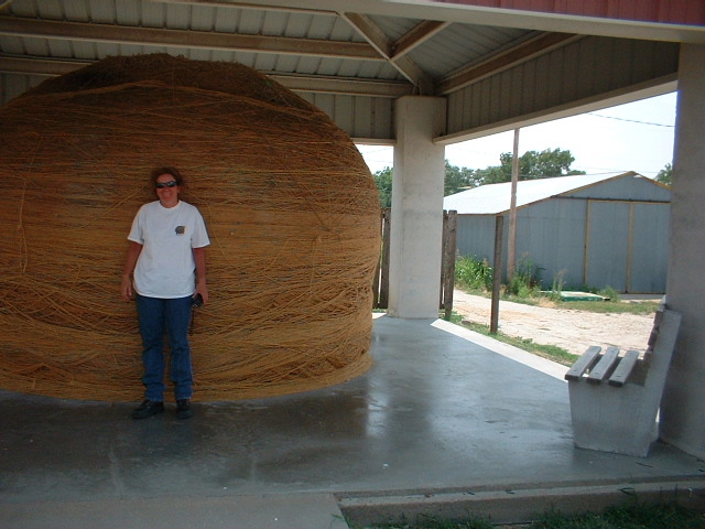 check
out the largest ball of twine. We rode on for several more
hours without incident before coming to the town of Manhattan, Nebraska.
Here we stopped for gas, but when we had filled up and were ready for the
last 50 miles of today’s trip to Topeka, my bike would not start and my
headlights were dead. All the other electrical worked correctly which ruled out
the battery. I was finally able to jump the starter solenoid to get it started,
but the lights were still out. Since this is against the law in some states, we
decided to stay here tonight and try to get it to a dealer 1st thing
in the morning.
check
out the largest ball of twine. We rode on for several more
hours without incident before coming to the town of Manhattan, Nebraska.
Here we stopped for gas, but when we had filled up and were ready for the
last 50 miles of today’s trip to Topeka, my bike would not start and my
headlights were dead. All the other electrical worked correctly which ruled out
the battery. I was finally able to jump the starter solenoid to get it started,
but the lights were still out. Since this is against the law in some states, we
decided to stay here tonight and try to get it to a dealer 1st thing
in the morning.
Today started a little different than most. I
started calling numbers looking for a local Honda dealer about 8 am. When I had
no luck, I started looking on the internet for the wiring diagram for my bike. I
was able to find one and although it made sense to me, I didn’t have a volt /
ohmmeter to check it with. I finally got a response from some of the dealers I
was tying about 9 am. The problem is it was not the response I wanted. It seems
that there is no Honda dealer within 500 miles of Manhattan, Kansas that is open
on either Sunday or Monday. I did
finally get hold of a dealer in Kansas City that had the parts department open,
but not the service dept. If you are ever in Kansas on a bike, DO NOT break down
on a Sunday or Monday. I decided to give up on a dealer and I went instead to a
Radio Shack. I found one open on other side of town and I bypassed the starter
solenoid with a pair of pliers and rode it across town.
The motel we were staying in, Super 8, although it was nice, the people
working there left a lot to be desired. We
ask for a late check out and were told no, in a manner that was unnecessary.
We had only stayed there because it was across the street from where we
had broken down. I won’t make that mistake again.
Anyway back to the Radio Shack. The people here were completely
different. Even though they were in the process of moving to a new location,
they took the time to help me find the items I needed and even let me borrow
their meter. I worked in their parking lot for more than three very hot hours,
but when I was finished I had rewired the starter with a new relay and switch. I
also added a new headlight switch to allow me to run legal. I thanked the guys
at Radio Shack and we headed again towards Topeka.
This stretch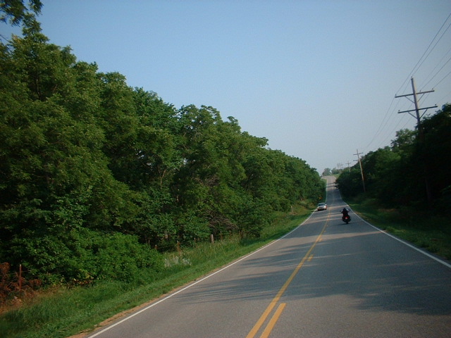 went without a hitch. We
hit the I-70 at this junction and headed for Kansas City.
I started noticing these signs indicating a toll road and started looking
for an off ramp. I wasn’t so much worried about the toll, but we wanted to be
able to drive the back roads. You cannot see much from the freeway. We saw this
sign that said, “Last Free Exit”, so we turned off. As we went around the
corner, we came to a tollbooth. I stopped and said I was looking for a way to
get off the Toll Road. She said just go down a couple of miles, pay the toll and
go around to the 70. It is a big
loop right back to where I started. We finally got off the freeway, looked at a
map and followed 29th until it left town east on highway 40. Now if
you followed all this, it took us another hour to get out of Topeka. By this
time all we could think of was that we wanted to get out of Kansas. We found the shortest (non Toll Jail) and headed for
Missouri. In a way I regret it because the last 100 miles of Kansas are probably
the most beautiful of the entire state. It was getting late when we got into
Kansas City, Missouri, so we are calling it a day. Tomorrow has got to be
better.
went without a hitch. We
hit the I-70 at this junction and headed for Kansas City.
I started noticing these signs indicating a toll road and started looking
for an off ramp. I wasn’t so much worried about the toll, but we wanted to be
able to drive the back roads. You cannot see much from the freeway. We saw this
sign that said, “Last Free Exit”, so we turned off. As we went around the
corner, we came to a tollbooth. I stopped and said I was looking for a way to
get off the Toll Road. She said just go down a couple of miles, pay the toll and
go around to the 70. It is a big
loop right back to where I started. We finally got off the freeway, looked at a
map and followed 29th until it left town east on highway 40. Now if
you followed all this, it took us another hour to get out of Topeka. By this
time all we could think of was that we wanted to get out of Kansas. We found the shortest (non Toll Jail) and headed for
Missouri. In a way I regret it because the last 100 miles of Kansas are probably
the most beautiful of the entire state. It was getting late when we got into
Kansas City, Missouri, so we are calling it a day. Tomorrow has got to be
better.
Heading
south out of Kansas City we started to see a lot more water and green than we
had so far. Most of the lakes and rivers we passed have been shallow, but
wide. Some of these are several miles wide even though they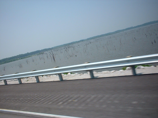 are only a few feet
deep. Another thing you notice is how straight the roads are even though they
are hilly. It's like a roller coaster that doesn't
turn. The sky is the vista
out here. You can see green meets blue everywhere you look. As we rolled through
the town of Ozark in Missouri, I was a little confused. I always thought that
was in Arkansas. As we continued on across the Arkansas boarder and through the
Ozark Mountains, I realized my mistake. I can't believe how many billboards are
on the roads around here. It seems that everybody is playing somewhere
around here. Only in Arkansas would you find a trout farm that is also a restaurant.
Catch em and eat em I guess. I can tell you this, the road we took from the
Arkansas boarder through the Ozarks is about 250 miles of the kind of ride we
can only find in California for about 20 miles at a time. Those curving, sloping,
winding, wooded, warm summer breeze roads where you can smell all the outdoors
smells we crave while the wind blows through our hair. Did I mention there is no
helmet law in this state? Well we gotta get to Little Rock before it gets
dark, so I'll write more later.
are only a few feet
deep. Another thing you notice is how straight the roads are even though they
are hilly. It's like a roller coaster that doesn't
turn. The sky is the vista
out here. You can see green meets blue everywhere you look. As we rolled through
the town of Ozark in Missouri, I was a little confused. I always thought that
was in Arkansas. As we continued on across the Arkansas boarder and through the
Ozark Mountains, I realized my mistake. I can't believe how many billboards are
on the roads around here. It seems that everybody is playing somewhere
around here. Only in Arkansas would you find a trout farm that is also a restaurant.
Catch em and eat em I guess. I can tell you this, the road we took from the
Arkansas boarder through the Ozarks is about 250 miles of the kind of ride we
can only find in California for about 20 miles at a time. Those curving, sloping,
winding, wooded, warm summer breeze roads where you can smell all the outdoors
smells we crave while the wind blows through our hair. Did I mention there is no
helmet law in this state? Well we gotta get to Little Rock before it gets
dark, so I'll write more later.
Today
we got started a little earlier than we have been. We left Little Rock and
headed south again. We immediately started crossing more rivers and creeks. I
guess the water we need so bad in the west is all out here. The roads in this
state are not as good as most we have been through, but the sights are worth the
difference. I think taking the back roads for the most part was a good
idea. My bike is still not right and I have to play with my makeshift
starter setup, but at least it is running good. I took my starter switch apart
on the handlebars, but everything is good there. I guess I am going to have to
make time to get it in to a dealer. Woods, trees, more  trees, lots and lots of
trees. If there is one thing that makes this part of Arkansas unique, it
is all of the trees. There are plenty of farms around, but mostly woods. I
am not complaining you understand, I am just overwhelmed. Even with all
the trees, there is not much shade on the road. It hit 107 today and has been
over 100 in every state we've been to. I wanted a warm ride, but this is too
much. As we neared the
boarders with Mississippi, we got our first look at the great Mississippi River.
I couldn't help but wonder what the first settlers must have thought when they
saw this place. The one thing that impressed me most about this location, was
the room. The city parks must have a football field size area for every resident
of these small towns. The houses are most all set back from the road on at least
an acre of land. As we crossed briefly
trees, lots and lots of
trees. If there is one thing that makes this part of Arkansas unique, it
is all of the trees. There are plenty of farms around, but mostly woods. I
am not complaining you understand, I am just overwhelmed. Even with all
the trees, there is not much shade on the road. It hit 107 today and has been
over 100 in every state we've been to. I wanted a warm ride, but this is too
much. As we neared the
boarders with Mississippi, we got our first look at the great Mississippi River.
I couldn't help but wonder what the first settlers must have thought when they
saw this place. The one thing that impressed me most about this location, was
the room. The city parks must have a football field size area for every resident
of these small towns. The houses are most all set back from the road on at least
an acre of land. As we crossed briefly into Louisiana and continued to follow
the river, we had a chance see some of these houses up close. I wonder how long
these same houses have been here. In LA they would have all been replaced by
some ordinance or another. Before we crossed the big river we had a chance
to ride through Transylvania. Yes you heard me right, it is in Louisiana.
We also got to see how they cut grass out here where there really is grass. We
finally crossed the Mississippi at Vicksburg, another chance to glance back at
history and wonder at how the two armies could have fought in the kind an
environment for months on end. Well that was another time. For now, another 60
miles to Jackson through some of the thickest forest we have seen yet. I thought
we would try for New Orleans tonight, but a nasty thunder shower put an
end to that. The rain was not bad, but water got high quick. We'll spend the
night in Jackson and head south in the morning.
into Louisiana and continued to follow
the river, we had a chance see some of these houses up close. I wonder how long
these same houses have been here. In LA they would have all been replaced by
some ordinance or another. Before we crossed the big river we had a chance
to ride through Transylvania. Yes you heard me right, it is in Louisiana.
We also got to see how they cut grass out here where there really is grass. We
finally crossed the Mississippi at Vicksburg, another chance to glance back at
history and wonder at how the two armies could have fought in the kind an
environment for months on end. Well that was another time. For now, another 60
miles to Jackson through some of the thickest forest we have seen yet. I thought
we would try for New Orleans tonight, but a nasty thunder shower put an
end to that. The rain was not bad, but water got high quick. We'll spend the
night in Jackson and head south in the morning.
We
headed south again as we left this morning, but after a short hop on the
freeway, we left the main road for highway 51. This road ran parallel to the
freeway, but gave us the tree lined country roads we like to ride on. We
got to see some of the typical southern establishments like the Stark Family Restaurants,
and the Piggly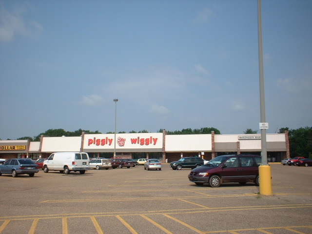 Wiggly stores. We saw many more of the houses on huge lots
and the new versus old ones in the same neighborhoods. The fact that all are
allowed to live as they want or can without interference from the well meaning
neighbors is amazing to me. We drove this road for another hundred miles of
trees, water, bridges and forests before crossing again into
Wiggly stores. We saw many more of the houses on huge lots
and the new versus old ones in the same neighborhoods. The fact that all are
allowed to live as they want or can without interference from the well meaning
neighbors is amazing to me. We drove this road for another hundred miles of
trees, water, bridges and forests before crossing again into 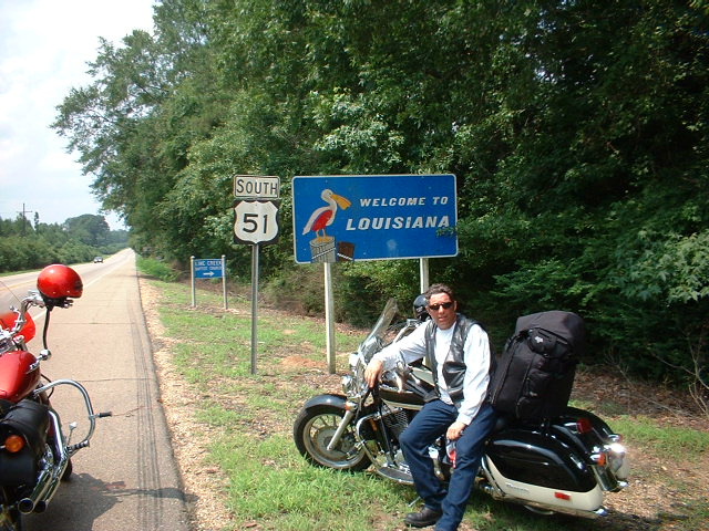 Louisiana. A
few more miles of similar terrain before we stopped for gas and had some
unexpected guests in the form of dragon flies that just wanted to use my mirror
for a few minutes. Then it was back on the road to cross the longest bridge I
have ever been on. It is 24 miles over the swamp before entering the city of New
Orleans. We got here around 1pm and had time to get a motel and take a break
before hitting the Bourbon Street crowd at dusk. Even though I
Louisiana. A
few more miles of similar terrain before we stopped for gas and had some
unexpected guests in the form of dragon flies that just wanted to use my mirror
for a few minutes. Then it was back on the road to cross the longest bridge I
have ever been on. It is 24 miles over the swamp before entering the city of New
Orleans. We got here around 1pm and had time to get a motel and take a break
before hitting the Bourbon Street crowd at dusk. Even though I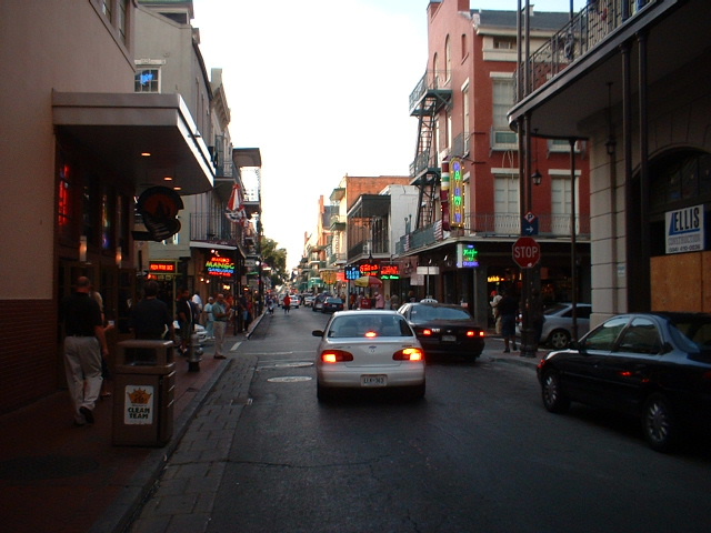 saw it for
myself, I still cannot believe they close the street down every night for the
walk through crowd. The noise level in overpowering, yet everyone gets into it.
A few of those special snacks and drinks and you just don't want to leave. But
leave we must for tomorrow we head east again.
saw it for
myself, I still cannot believe they close the street down every night for the
walk through crowd. The noise level in overpowering, yet everyone gets into it.
A few of those special snacks and drinks and you just don't want to leave. But
leave we must for tomorrow we head east again.
After checking out of our hotel very late, Bourbon Street is
harder to leave the longer you stay, we headed north east and left the New
Orleans area. The freeway was jammed with traffic until we hit the bridge.
I have never seen so many bridges. After crossing several of these bridges and
getting back to solid ground, we stopped for a late breakfast. Then it was
across the state line into Mississippi again. This time we rode the coast road.
The 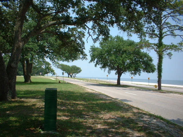 beaches are so different than ours back home. The sand is white and fine and
the houses are away from the beach. We stayed on this road up through Biloxi and
stopped at one of the
beaches are so different than ours back home. The sand is white and fine and
the houses are away from the beach. We stayed on this road up through Biloxi and
stopped at one of the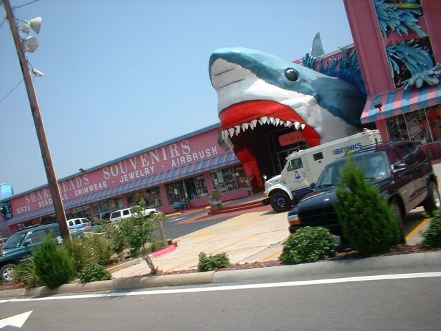 largest gift shops I have ever seen. If you want to
see souvenir stuff, the place to go is Shark Heads. Leaving Biloxi and
heading toward Pascagoula, it started to rain. We were ready this time and had
covers for our T-bags and we just kept on
riding. The rain was stubborn
though and
stayed with us right on across the Alabama state
line. We had already decided we
would be more stubborn though and we kept riding. As we got close to Mobile, we
took a fork in the road that took us toward Pensacola. As we rode on into
Mobile, we had the best weather we had had for the entire trip so far. It
was warm with no wind, cloudy with no cold, and the traffic was light.
Then we entered a tunnel in the middle of town that took us out onto another
bridge. It was the same town but on this bridge it got windy. Once we crossed
Mobile Bay, the rest of the ride to the Florida state line was beautiful but
eventless. We stopped for pictures and removed our helmets. I cannot explain the
way it feels to go topless on the road, but it is just something we find worth
the risk. A patrol car sat across the highway and watched us the entire
time we stayed at the boarder, but ignored us as soon as we left. Another
50 miles took us into Pensacola where we headed south on the 110. Due to
our late start, we decided to stay here so that we could take the bridge across
to Gulf Breeze in the daylight. Did I mention that by now we were completely
dry. One other thing I'd like to mention is the people. We have been
treated nice by most everyone in all states we've been through. With a very few
exceptions, every person we see and talk to is just the greatest. Until tomorrow...
largest gift shops I have ever seen. If you want to
see souvenir stuff, the place to go is Shark Heads. Leaving Biloxi and
heading toward Pascagoula, it started to rain. We were ready this time and had
covers for our T-bags and we just kept on
riding. The rain was stubborn
though and
stayed with us right on across the Alabama state
line. We had already decided we
would be more stubborn though and we kept riding. As we got close to Mobile, we
took a fork in the road that took us toward Pensacola. As we rode on into
Mobile, we had the best weather we had had for the entire trip so far. It
was warm with no wind, cloudy with no cold, and the traffic was light.
Then we entered a tunnel in the middle of town that took us out onto another
bridge. It was the same town but on this bridge it got windy. Once we crossed
Mobile Bay, the rest of the ride to the Florida state line was beautiful but
eventless. We stopped for pictures and removed our helmets. I cannot explain the
way it feels to go topless on the road, but it is just something we find worth
the risk. A patrol car sat across the highway and watched us the entire
time we stayed at the boarder, but ignored us as soon as we left. Another
50 miles took us into Pensacola where we headed south on the 110. Due to
our late start, we decided to stay here so that we could take the bridge across
to Gulf Breeze in the daylight. Did I mention that by now we were completely
dry. One other thing I'd like to mention is the people. We have been
treated nice by most everyone in all states we've been through. With a very few
exceptions, every person we see and talk to is just the greatest. Until tomorrow...
We left Pensacola at a reasonable hour and headed across the
bay. It looked like it was going to be a great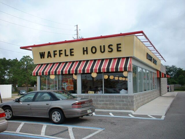 day. We stopped in a Waffle House
for breakfast after about 45 minutes of driving. We were waited on by this cute
little gal that kept doing a little skip-shuffle over the mats out of the
kitchen whenever she brought us something. It looked just a dance step for a
country dance, so we decided it should be named "The Waffle House
Shuffle". I think she liked the idea because she started giving it a little
extra emphasis from then on whenever she did it. So don't be surprised if
one day you are down south and you see them doing the "The Waffle House
Shuffle" as they bring your breakfast. Back on the road we headed
north and were only on the road about 30 miles when it started to rain.
Another 10 miles and we had to pull over because it was raining so hard we
couldn't see
day. We stopped in a Waffle House
for breakfast after about 45 minutes of driving. We were waited on by this cute
little gal that kept doing a little skip-shuffle over the mats out of the
kitchen whenever she brought us something. It looked just a dance step for a
country dance, so we decided it should be named "The Waffle House
Shuffle". I think she liked the idea because she started giving it a little
extra emphasis from then on whenever she did it. So don't be surprised if
one day you are down south and you see them doing the "The Waffle House
Shuffle" as they bring your breakfast. Back on the road we headed
north and were only on the road about 30 miles when it started to rain.
Another 10 miles and we had to pull over because it was raining so hard we
couldn't see  through the drops. We stopped at a place called the
"Plum Crazy", a sort of general store north of Panama City. A little
gal there named Mollie with an "ie" made us some hot boiled peanuts.
This is a taste she said that you either like or you don't. I guess it's kind of
like opera, except these I kinda liked these. When you chew on these, they are
soft, more like a bean of some kind. Still they could grow on you. We waited
here for quite a while waiting for the rain to stop. It never did, but when it
slowed down enough we rode on in the rain. It rained all the way to Tallahassee
and we were soaked to the bone when we got here. We decided to call it a day and
headed for a laundromat. We thought if we could just crawl into a dryer for a
while, maybe 2 or 3 cycles and we'd be ok. We found a motel and got dry and
slept way too long. This will be going on the web site late because it is already
10 am and we gotta get going.
through the drops. We stopped at a place called the
"Plum Crazy", a sort of general store north of Panama City. A little
gal there named Mollie with an "ie" made us some hot boiled peanuts.
This is a taste she said that you either like or you don't. I guess it's kind of
like opera, except these I kinda liked these. When you chew on these, they are
soft, more like a bean of some kind. Still they could grow on you. We waited
here for quite a while waiting for the rain to stop. It never did, but when it
slowed down enough we rode on in the rain. It rained all the way to Tallahassee
and we were soaked to the bone when we got here. We decided to call it a day and
headed for a laundromat. We thought if we could just crawl into a dryer for a
while, maybe 2 or 3 cycles and we'd be ok. We found a motel and got dry and
slept way too long. This will be going on the web site late because it is already
10 am and we gotta get going.
 considered a little boring to one who likes the hills. Still there was so much to see, I didn't mind at all. The one thing that I am still impressed by is all the green that the rain provides. Today we got not one drop of rain. It was rather cloudy most of the day, but it was on and off sunny so we also had time to get emotionally dried out. There are so many little towns and so many people that reside way out of the city, that I have difficulty understanding how they are all able to maintain a living. I never understood before why so many move to Florida when it is so humid, but I am starting to get the picture. The streams, rivers, and lakes, along with all the forests and swamps, make this a real paradise. It is easy to see myself living here. Anyway back to the ride. Leaving through downtown Tallahassee we were able to pass the capitol building before riding through Wakulla and over to Perry. This is I guess mostly swampland and National wildlife refuge areas, but it seemed like beautiful forests that go on and on to me. Heading southeast from Perry and somewhat following the coast was more of the
 same type of terrain, but with a little less water and a lot more privately owned land. I am not sure what goes on here because the roads all seem to go into the woods and disappear, but these are definitely roads that get usage. As we got closer to the Tampa area and drove through the coast towns of Spring Hill, Palm Harbor, Dunedin, and Clearwater, we decided to stay in St. Petersburg and cross the Tampa Bay from here. We will miss the city of Tampa, but it will give us a good start on tomorrow. A little catching up won't hurt us. I'm going to close this out now so I can eat and get to bed a little earlier than we have been. Tomorrow we head for the
southern most point in Florida.
same type of terrain, but with a little less water and a lot more privately owned land. I am not sure what goes on here because the roads all seem to go into the woods and disappear, but these are definitely roads that get usage. As we got closer to the Tampa area and drove through the coast towns of Spring Hill, Palm Harbor, Dunedin, and Clearwater, we decided to stay in St. Petersburg and cross the Tampa Bay from here. We will miss the city of Tampa, but it will give us a good start on tomorrow. A little catching up won't hurt us. I'm going to close this out now so I can eat and get to bed a little earlier than we have been. Tomorrow we head for the
southern most point in Florida.
We left St. Petersburg over yet another bridge. This was different from the others in it's height. There were also two other bridges that went a majority of the way to the center, then stopped abruptly with a fishing pier. They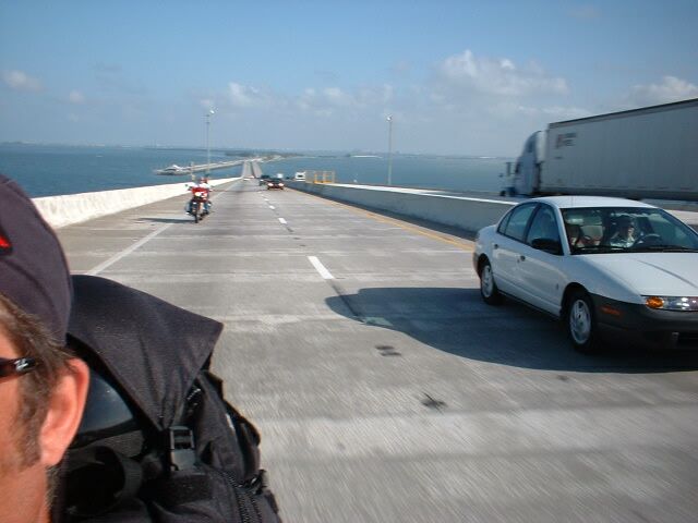 were labeled as national parks. I guess the state of Florida has a different idea about the makeup of a park than the rest of us. The view from this bridge was outstanding though. Boats, cities, parks and jungle, (everglades to the locals) can all be seen from there. Venice was not what I expected to find on the other side, but there it was. I keep seeing something new on the other side of the hill. They have so much water here that the bridge building seems to go on perpetually. The power plants I have seen on the river seem to be few, but I guess enough to provide the power they need. I no sooner thought this than I see a nuclear plant in the distance. As we started to cross the central part of Florida from west to east, we come up on a toll way named "Alligator Alley". It looks like they dug a trench about 30 miles long and then another like a few hundred yards away, fenced it off,
 then built a road between them. I guess it gives the alligators a natural home and keeps them off the road at the same time. this is one of the most boring roads we've been on, not because of the beauty, but the same exact landscape for almost 40 miles. We had to stop and dump water over our heads just to stay awake. Then just as we are nearing the end, clouds. Big black ones full of water. I decided to turn south quicker and try to outrun them. We succeeded, but just barely. We decided to call it a night in south Miami and try again tomorrow.
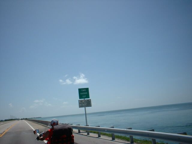
We started out heading south and the road as usual was steamy and hot. I was told last night that we just missed the worst of the rain
because last month it rained nearly every day. I know he meant it to make me feel better, but it only reminded me of how humid it is here. I thought the problem would be the sweat, but rather the air kind of fills your head and plugs your sinuses. This generally stabilizes an hour or so in the heat, but by then you are ready to stop for water and it starts all over again. I guess you could get used to it in time. I notice slight differences in the way Florida deals with things like
bus stops. There is an awning that curves out over the stop and the bus when it is there to give the riders a little relief from the sun. As we start on the "Dixie Hwy" that this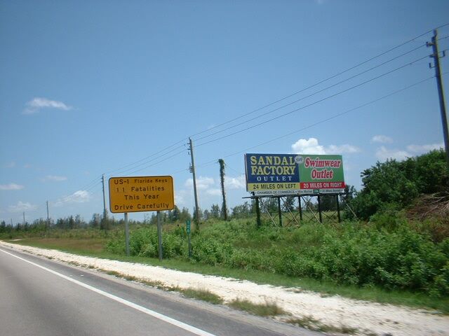 highway one is called, and head for the Keys, I notice a
sign that indicates only 11 people have been killed on this road this year, so be careful. The road is not what I expected. I thought all we'd see would be water. Instead there are plants and trees most of the way on both sides of the road. They have built up several parts of the road and replaced several parts of the highway. Where there are breaks in the plant life, I try to get pictures. I figured to get a picture of all 6 or 7 of the signs that name the keys. Boy was I out of touch. I have been ignorant of Florida and certainly of the Keys. There are dozens of these
highway one is called, and head for the Keys, I notice a
sign that indicates only 11 people have been killed on this road this year, so be careful. The road is not what I expected. I thought all we'd see would be water. Instead there are plants and trees most of the way on both sides of the road. They have built up several parts of the road and replaced several parts of the highway. Where there are breaks in the plant life, I try to get pictures. I figured to get a picture of all 6 or 7 of the signs that name the keys. Boy was I out of touch. I have been ignorant of Florida and certainly of the Keys. There are dozens of these
 little islands. I guess they are not exactly islands, but there are a lot more than I thought. I took 181 pictures by the time we rode from Key Largo to Key West. I will trim them some before uploading them. Once we got here and checked in, we went to the Tiki bar to watch the
sun go down. While we are waiting I realize that it is only 8pm and that at home people are still working. I almost took some special pics to upload on the spot, but decided that would be mean. Still I didn't do it
because I wanted to stay at the bar. I got the sunset pics anyway so you can see what it looked like from the hotel. I guess this is about half way, so we will head north tomorrow and start on the trek home. Later...
little islands. I guess they are not exactly islands, but there are a lot more than I thought. I took 181 pictures by the time we rode from Key Largo to Key West. I will trim them some before uploading them. Once we got here and checked in, we went to the Tiki bar to watch the
sun go down. While we are waiting I realize that it is only 8pm and that at home people are still working. I almost took some special pics to upload on the spot, but decided that would be mean. Still I didn't do it
because I wanted to stay at the bar. I got the sunset pics anyway so you can see what it looked like from the hotel. I guess this is about half way, so we will head north tomorrow and start on the trek home. Later...
As
we loaded up and left Key West behind us and started up the road, we got to
watch the planes from the air 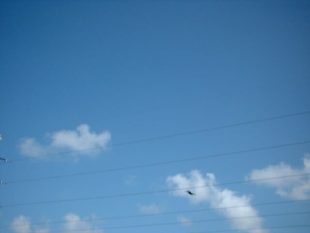 base play a little tag as they circled the
island. It is kind of startling to realize that by the time they get off
the ground, they are already starting the turn to get back to the base. If you
are not quick, they already have the wheels down and are landing before you can
get a picture. I thought they must be having a lot of fun by the way they flew.
I didn't take so many pictures on the way back because I took so many they day
before. I did get some of the Keys I missed and I got a picture of the monster
they use to trim the trees along the highway. It looks like a helicopter on it's
side when it is spinning. Wouldn't you know it, as soon as we left the Keys, it
started to cloud up and yes, it pored. We had to stop and get out of the
rain long enough to get on our rain gear. We started out again and within
minutes it cleared up and stopped. We stopped again and took off our gear
and then followed the 1 again. Within an hour it started to cloud up again, but
we were now heading to the actual coast and the clouds were going straight
north. We went through downtown Miami
base play a little tag as they circled the
island. It is kind of startling to realize that by the time they get off
the ground, they are already starting the turn to get back to the base. If you
are not quick, they already have the wheels down and are landing before you can
get a picture. I thought they must be having a lot of fun by the way they flew.
I didn't take so many pictures on the way back because I took so many they day
before. I did get some of the Keys I missed and I got a picture of the monster
they use to trim the trees along the highway. It looks like a helicopter on it's
side when it is spinning. Wouldn't you know it, as soon as we left the Keys, it
started to cloud up and yes, it pored. We had to stop and get out of the
rain long enough to get on our rain gear. We started out again and within
minutes it cleared up and stopped. We stopped again and took off our gear
and then followed the 1 again. Within an hour it started to cloud up again, but
we were now heading to the actual coast and the clouds were going straight
north. We went through downtown Miami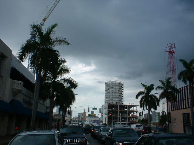 and got to see the new construction,
Whoopee, and a girl that looked very impatient waiting on the L train.
There is one place on the 1 that actually lines the street with trees that
completely drape the road. This was just before downtown. We also got to see
several famous beaches and even a trip through Hollywood. It is just not
the same as back home. Karen was starting to get a little grumpy when I realized
I had not fed her since breakfast and it was about 7pm. So we stopped for dinner
and decided we should just find a place to tuck in for the night. We found a
cute little place called the Pier Pointe, an it is actually on the beach in Ft.
Lauderdale. The price, with coupon, is only $45.00 a night. We haven't planned
out our day tomorrow, so I guess you will just have to wait until then.
and got to see the new construction,
Whoopee, and a girl that looked very impatient waiting on the L train.
There is one place on the 1 that actually lines the street with trees that
completely drape the road. This was just before downtown. We also got to see
several famous beaches and even a trip through Hollywood. It is just not
the same as back home. Karen was starting to get a little grumpy when I realized
I had not fed her since breakfast and it was about 7pm. So we stopped for dinner
and decided we should just find a place to tuck in for the night. We found a
cute little place called the Pier Pointe, an it is actually on the beach in Ft.
Lauderdale. The price, with coupon, is only $45.00 a night. We haven't planned
out our day tomorrow, so I guess you will just have to wait until then.
Although
I realize our forefathers didn't know much about asphalt, at times I think the Dixie Hwy
has not been upgraded since they were here. With all the money spent in Palm
Beach, it seems like some of it could have been spent on the road. I think
there must be an ordinance that says there must be a torn up piece of road at a
minimum of every 150 feet. If the riders that ride Florida's Hwy One
ever come out to California and ride our Hwy One, they will never go back to
Florida. Now I am not saying that I gave up on it, We rode this hwy from Key
West all the way up to Jacksonville. Would I ever do it again? Not until they fix it. There are some beautiful parts of this road as there are back
home, and there are some places that run for scores of miles uninterrupted. All
in all I'd say it is an experience worth the trip. We came for an adventure and
we are certainly getting that. I tried to get some shots of the towns we
went through, but they always come up on you so suddenly I usually miss the
picture. I try to get something with the name on it, so you will see some funny angles. This road is not really the coast road, it has a sort of river
that separates it from an outer island, so you sometimes see the water and
sometimes see the ocean, but mostly you see neither. You do see a lot of
rivers, cannels, and creeks. The creeks down here and the ones in Louisiana
are like the rivers back home. Or I should the rivers back home are smaller than
the creeks here. There are places here where you can own
angles. This road is not really the coast road, it has a sort of river
that separates it from an outer island, so you sometimes see the water and
sometimes see the ocean, but mostly you see neither. You do see a lot of
rivers, cannels, and creeks. The creeks down here and the ones in Louisiana
are like the rivers back home. Or I should the rivers back home are smaller than
the creeks here. There are places here where you can own  a 10 ft piece of
land from the road to the water. All you need is a dock I guess. Some of them
are fancy and some so dilapidated they have been deserted. But I guess if you
own it, it stays the way you leave it. It is common here to see signs that
show 10, 50, or even a 100 or more acres for sale in a good location next to the
water. The price back in California would be staggering, but here it is
reachable. I had almost forgotten that Cape Kennedy was once Cape
Canaveral. The
sign is still here anyway. Fishing along here seems to be the only item
anyone is aware of. I suppose they look up when a shuttle takes off, but I
wouldn't bet on it.. As we
cross over the last few bridges and pass through the last hours of
light, we
pull into Jacksonville and the last large city in Florida. In the morning we
will head for Georgia. Oh, let us not forget to thank the girl that checked us in
on our last night in Florida.
a 10 ft piece of
land from the road to the water. All you need is a dock I guess. Some of them
are fancy and some so dilapidated they have been deserted. But I guess if you
own it, it stays the way you leave it. It is common here to see signs that
show 10, 50, or even a 100 or more acres for sale in a good location next to the
water. The price back in California would be staggering, but here it is
reachable. I had almost forgotten that Cape Kennedy was once Cape
Canaveral. The
sign is still here anyway. Fishing along here seems to be the only item
anyone is aware of. I suppose they look up when a shuttle takes off, but I
wouldn't bet on it.. As we
cross over the last few bridges and pass through the last hours of
light, we
pull into Jacksonville and the last large city in Florida. In the morning we
will head for Georgia. Oh, let us not forget to thank the girl that checked us in
on our last night in Florida.
 Leaving Florida did not bother me. Even the last few miles,
they had to make sure we got more construction. I think the state gets a
discount if they buy those cones by the thousand. They start putting them out 10
miles before the actual construction and 10 miles after. As we went
through Georgia on the I-95, I have to say the one thing that stands out about
this state is the rivers. There are a lot of them and they are big, or wide at
least. I understand that this is because there is so much swampland and
they have to keep draining it. Whatever reason it makes for beautiful scenery.
We drove right through the state stopping only for gas and then as we entered
South Carolina, we took a slight detour to Hilton Head Island where I had just
found out the day before that another of my brothers lives. We stopped and had
lunch and a long chat, and I met my nephew for the first time. He is 20 now so I
guess it is about time. Back on the road
Leaving Florida did not bother me. Even the last few miles,
they had to make sure we got more construction. I think the state gets a
discount if they buy those cones by the thousand. They start putting them out 10
miles before the actual construction and 10 miles after. As we went
through Georgia on the I-95, I have to say the one thing that stands out about
this state is the rivers. There are a lot of them and they are big, or wide at
least. I understand that this is because there is so much swampland and
they have to keep draining it. Whatever reason it makes for beautiful scenery.
We drove right through the state stopping only for gas and then as we entered
South Carolina, we took a slight detour to Hilton Head Island where I had just
found out the day before that another of my brothers lives. We stopped and had
lunch and a long chat, and I met my nephew for the first time. He is 20 now so I
guess it is about time. Back on the road now but several hours late, we needed
to make it to Fayetteville because the bikes have to go in for service and they
have to be there by 9 am. The dealership was kind enough to take in both bikes
on short notice do the warranty service. We have put more than 5000 miles on
them since we left home, so I figure they deserve to be pampered a little
too. It looks like I may need a new tire as well. Well it took us until midnight to get here, but we made it. Fortunately another brother and my
mother live here so we will have a place to stay. We usually do not like to ride
at night, in fact we usually stop by 5 or 6 pm. Still we made the trip and we
got here safe. I only regret that part of the trip, the dark
part, we were
unable to see the sights. Tomorrow after the bikes are in the shop, we'll have
time to visit and recoup.
now but several hours late, we needed
to make it to Fayetteville because the bikes have to go in for service and they
have to be there by 9 am. The dealership was kind enough to take in both bikes
on short notice do the warranty service. We have put more than 5000 miles on
them since we left home, so I figure they deserve to be pampered a little
too. It looks like I may need a new tire as well. Well it took us until midnight to get here, but we made it. Fortunately another brother and my
mother live here so we will have a place to stay. We usually do not like to ride
at night, in fact we usually stop by 5 or 6 pm. Still we made the trip and we
got here safe. I only regret that part of the trip, the dark
part, we were
unable to see the sights. Tomorrow after the bikes are in the shop, we'll have
time to visit and recoup.
Today has been a special as well as an expensive day.
First we passed a topless church in the "Bible Belt". Now that has to
be special. We
took the bikes into Meridian Honda in Fayetteville, North Carolina for their
warranty servicing and got them back with a $600 bill attached. Not to complain
you understand, they took us in on short notice and did the servicing on a Saturday.
I had to have a rear tire replaced as well as the normal tune-up. It has
just always amazed me that a "warranty service" costs in the
neighborhood of $200. The bikes are back in tip-top shape and should make it
back to California. Of course I still have an altered ignition switch, because
they did not expect to have time to get to that part of the job and doubted they
would have the parts in stock anyway. At least I can ride it and the only thing
my patch job does not give me, is hi-beams. The other side of the story is the
people. They were friendly and did the job as promised. I got to spend the day
with my  brother, one of our servicemen from Ft. Bragg, and my Mother and we got to
see the airborne and special ops museum. We also had a wonderful dinner at Joe's
Crab Shack. Not only did we enjoy a fine meal and conversation, we also got
entertainment as the "Crab Shack" girls did a special dance for the
customers. Now I need to complete this page and set up for tomorrow's run. Enjoy
the pics, we did.
brother, one of our servicemen from Ft. Bragg, and my Mother and we got to
see the airborne and special ops museum. We also had a wonderful dinner at Joe's
Crab Shack. Not only did we enjoy a fine meal and conversation, we also got
entertainment as the "Crab Shack" girls did a special dance for the
customers. Now I need to complete this page and set up for tomorrow's run. Enjoy
the pics, we did.
We
left Fayetteville this morning after saying goodbye to family and almost immediately
found it harder to find the right way out of town than finding our way in. Soon
we were back on the 301 heading north east for the coast. We wanted to check out
Kitty Hawk and this was as close as we were going to get. The lakes, the
rivers, and even the muddy creeks lend a kind of glow to the scenes along the
back roads. When you add the architecture and the differences from one house to
the next to the reflections of the water, the result is spectacular. It is
amazing that they never seem to tear down a building back here, they just put up
another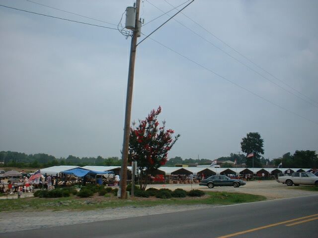 somewhere else on the property. I guess if you have enough room,
you may as well keep the old one. What we call a swap meet, they call a
flea market. They are everywhere out here and they just seem to put up tents
alongside the road to do it. Another interesting fact I noticed, perhaps it is
because it is Sunday, that most of the cemeteries have flowers on all the
sites,
not on just a select few. The roads in this area don't have much in the
way of population, it is common to drive 50 to 60 miles without seeing a house
anywhere. Still all the beauty around keeps you from being aware you are
in the middle of nowhere. That is until you realize the last sign you saw said alligator
refuge and the one you are looking says Naval Bombing Range. Then you notice you
have not seen another car for the last half hour or so. But a few miles farther
on and things seem to go back to normal. Then you ride around a curve and you
see the ocean and you realize you are on the last stretch before the Outer
Banks. A few more small towns and a few bridges, and there is the sign that
says, "Roanoke Island". One last "forever" bridge and you
are there. Nags Head and Kitty Hawk. Then just as you are about to
look for your hotel, those black clouds appear out of nowhere. Just a few
drops this time though. Not even enough to wipe off. Well another day comes to
an end. One more visit tomorrow, then back home. It seems we used up all
our spare days. Oh well we still have the trip home. Untill next
time...
somewhere else on the property. I guess if you have enough room,
you may as well keep the old one. What we call a swap meet, they call a
flea market. They are everywhere out here and they just seem to put up tents
alongside the road to do it. Another interesting fact I noticed, perhaps it is
because it is Sunday, that most of the cemeteries have flowers on all the
sites,
not on just a select few. The roads in this area don't have much in the
way of population, it is common to drive 50 to 60 miles without seeing a house
anywhere. Still all the beauty around keeps you from being aware you are
in the middle of nowhere. That is until you realize the last sign you saw said alligator
refuge and the one you are looking says Naval Bombing Range. Then you notice you
have not seen another car for the last half hour or so. But a few miles farther
on and things seem to go back to normal. Then you ride around a curve and you
see the ocean and you realize you are on the last stretch before the Outer
Banks. A few more small towns and a few bridges, and there is the sign that
says, "Roanoke Island". One last "forever" bridge and you
are there. Nags Head and Kitty Hawk. Then just as you are about to
look for your hotel, those black clouds appear out of nowhere. Just a few
drops this time though. Not even enough to wipe off. Well another day comes to
an end. One more visit tomorrow, then back home. It seems we used up all
our spare days. Oh well we still have the trip home. Untill next
time...
We
got to the hotel about dark yesterday and did not get a chance to look around in
the daylight, so this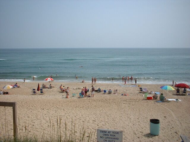 morning before we left, I got a few pics of the Kitty
Hawk's beach around the hotel. We found that our ocean side room came with
a "Dune View". The beach was beautiful, but we had no time to enjoy
it. Most people don't mind if you take their picture, but some do. We got
back on the road and found again some of the best scenery we are likely to ever
see. I guess I am still stuck on the differences in the allowed architecture. As
we crossed over into Virginia, we came across a store that actually operated in
both states. The state line ran right down the middle of the store. I wonder if
they have to pay taxes in both states. Karen found a little knick-knack
that she had to have. They would not ship and we had no room to carry it, so I
got a picture and I'll try to build it later. In the new state, the first thing
we hit is a toll road. I don't think these people have heard of "freeways".
This is the first stretch of road we came across vegetation that is not all
green. Red crops appeared but were then gone. We finally crossed the bridge into
Virginia Beach and the last place we would see the Atlantic Ocean. We decided to
stop for a banana split on the ocean walk before continuing. As soon as we left
the Dairy Queen, we
morning before we left, I got a few pics of the Kitty
Hawk's beach around the hotel. We found that our ocean side room came with
a "Dune View". The beach was beautiful, but we had no time to enjoy
it. Most people don't mind if you take their picture, but some do. We got
back on the road and found again some of the best scenery we are likely to ever
see. I guess I am still stuck on the differences in the allowed architecture. As
we crossed over into Virginia, we came across a store that actually operated in
both states. The state line ran right down the middle of the store. I wonder if
they have to pay taxes in both states. Karen found a little knick-knack
that she had to have. They would not ship and we had no room to carry it, so I
got a picture and I'll try to build it later. In the new state, the first thing
we hit is a toll road. I don't think these people have heard of "freeways".
This is the first stretch of road we came across vegetation that is not all
green. Red crops appeared but were then gone. We finally crossed the bridge into
Virginia Beach and the last place we would see the Atlantic Ocean. We decided to
stop for a banana split on the ocean walk before continuing. As soon as we left
the Dairy Queen, we  came across the most appropriate sign for this part of our
trip, 'South or North, Pacific or Atlantic'. I guess it is time to head
for home. As soon as Karen heard this I had a heck of a time trying to catch up
with her. I think she is ready to go back. This time we got a tunnel
under the river instead of a bridge over it. We stopped just outside of
Richmond to visit my sister and her husband. Having seen all my relatives I
expect to see on this trip, we should be able to take a more direct path
home. We have about 3,000 miles to cover and about 11 days to do it.
Baring trouble, we should be able to make it. Now I've got to plan tomorrows
route, so until next time...
came across the most appropriate sign for this part of our
trip, 'South or North, Pacific or Atlantic'. I guess it is time to head
for home. As soon as Karen heard this I had a heck of a time trying to catch up
with her. I think she is ready to go back. This time we got a tunnel
under the river instead of a bridge over it. We stopped just outside of
Richmond to visit my sister and her husband. Having seen all my relatives I
expect to see on this trip, we should be able to take a more direct path
home. We have about 3,000 miles to cover and about 11 days to do it.
Baring trouble, we should be able to make it. Now I've got to plan tomorrows
route, so until next time...
Today
was a mixed bag of good and bad. We left late, but had good weather to
ride in. The scenery was all the same, but it was all beautiful. We were not
exactly on back roads, but they were great roads to ride on. Karen was not
feeling well and wanted to stop early, but it started to rain right after we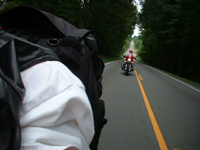 stopped. The pictures did not come out too well because it was hazy a lot of the
day, but I didn't take very many pictures. The rolling hills of the Blue Ridge
mountains certainly has its lure. This part of the country is very much as I
expected it to be and I have never been here before. It is like being out
in the country and still being in the outskirts of the city. After we
checked in, I went for a ride around the city, and even though it was raining, I
didn't really notice it. Maybe I'm starting to loose it, but riding around
the country just absorbing the sites, sounds, and smells is intoxicating. I
guess we all have our addictions. Well, I'd better get this uploaded and try to
get some sleep for tomorrow is likely to be another long day. Until then....
stopped. The pictures did not come out too well because it was hazy a lot of the
day, but I didn't take very many pictures. The rolling hills of the Blue Ridge
mountains certainly has its lure. This part of the country is very much as I
expected it to be and I have never been here before. It is like being out
in the country and still being in the outskirts of the city. After we
checked in, I went for a ride around the city, and even though it was raining, I
didn't really notice it. Maybe I'm starting to loose it, but riding around
the country just absorbing the sites, sounds, and smells is intoxicating. I
guess we all have our addictions. Well, I'd better get this uploaded and try to
get some sleep for tomorrow is likely to be another long day. Until then....
We
actually got an early start this morning. We also got a dose of fog, not
what we were expecting. Then we decided to try the 52 highway through West
Virginia and see a real coal mining community. At one point we pulled
off on a little gravel exit to check Karen's rear tire. It was a little steep
and when she tried to look back at the tire without getting off, her bike
decided it was tired and just laid down. It wouldn't have been a problem, except
for the steel guardrail that was not willing to yield to her windshield. We just
removed the pieces and continued without it. We did get to see coal mining area, but
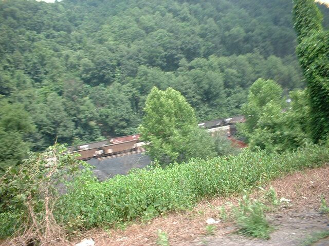 we also
got to ride mountain roads, lots of trucks and trains hauling coal and two separate
accidents. One was a truck that turned over when his steering locked up and he
ran off the road, then turned over on the road. The other was a white Camero
that looked to have just missed a turn and ran off the road. On top of
these items, we went around a curve and nearly ran into the back of a truck that
had just stopped in the road. Even with all this, I am still glad we took the
road it was a gorgeous run. Typical mountain roads, a river running
alongside,
trees everywhere, lots of sunny shade. What more could you ask for in a
ride. We finally got off of the 52 and headed south. The road was much
wider and an easy ride. I was amazed at the way the canyons looked as if it
had been carved out with some kind of gigantic knife.
we also
got to ride mountain roads, lots of trucks and trains hauling coal and two separate
accidents. One was a truck that turned over when his steering locked up and he
ran off the road, then turned over on the road. The other was a white Camero
that looked to have just missed a turn and ran off the road. On top of
these items, we went around a curve and nearly ran into the back of a truck that
had just stopped in the road. Even with all this, I am still glad we took the
road it was a gorgeous run. Typical mountain roads, a river running
alongside,
trees everywhere, lots of sunny shade. What more could you ask for in a
ride. We finally got off of the 52 and headed south. The road was much
wider and an easy ride. I was amazed at the way the canyons looked as if it
had been carved out with some kind of gigantic knife. 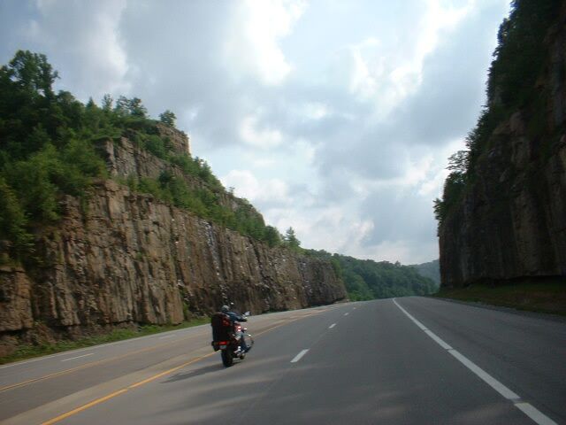 Miles and
miles of these roads made me really wonder how it was done. Karen finally wore
out her back tire. I had to have mine replaced back in North Carolina. We
are now going to have to see if we can get it replaced when we get to
Nashville. That will put us back another half day, so now we are going to
have to start making up some time
Miles and
miles of these roads made me really wonder how it was done. Karen finally wore
out her back tire. I had to have mine replaced back in North Carolina. We
are now going to have to see if we can get it replaced when we get to
Nashville. That will put us back another half day, so now we are going to
have to start making up some time
Getting to Nashville before the Honda dealer closes requires
leaving at a normal time this morning. About the same as yesterday though,
the weather did not exactly cooperate. The fog in the morning was not too
bad, but around noon the rain decided we had been left alone long enough. We
waited it out under some trees and then got back on the road with only about a
half hour lost. Riding down the Daniel Boone Parkway was not what I had
expected. First it was a toll road and in desperate need of
repair. Second it had
nothing to do with historic sites that you could see. Still it made me think of
a time gone by 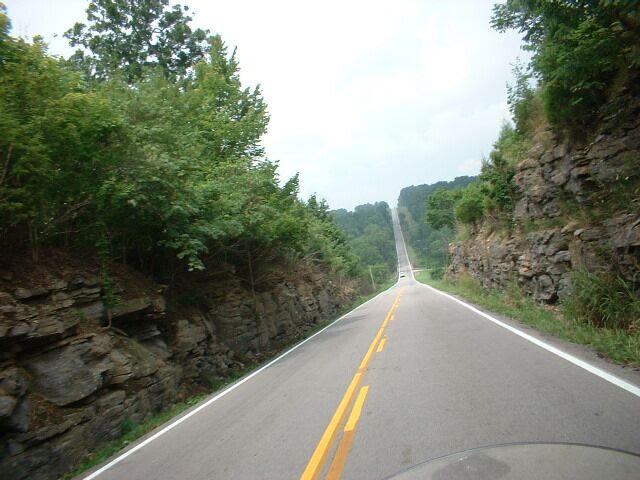 and the way they had to live back then, or got to live, depending
on your point of view. The tolls I should not complain
about because they are usually 20 to 50 cents up to a dollar. We got a little wet
and it
and the way they had to live back then, or got to live, depending
on your point of view. The tolls I should not complain
about because they are usually 20 to 50 cents up to a dollar. We got a little wet
and it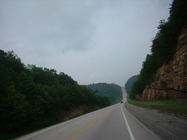 played with us for another hour or so, but it did clear up and we were
dry by the time we got to Nashville. Even with the fog and the rain, the
roads were a pleasure to ride. The long sloping mountain highways, with
their rivers and streams are the kind of scenic roads you only see in pictures.
Where else but Kentucky would you find a cemetery that is dedicated to the Smith
clan? I even took one picture of what looks to be a park, that is in fact
just someone's front yard. This is for sure one of the most beautiful states I
have been in and I found myself right at home. Well, all except the y'all we
kept hearing from the locals. The dealership in Nashville, Tennessee
was true to their word and
took us in to replace Karen's tire and a cracked windshield. We left the dealer
at 6pm and had time to get a motel before dark. We had a nice meal at the local
Hooters a short walk from the hotel and now its time to update the web. Until next time.
played with us for another hour or so, but it did clear up and we were
dry by the time we got to Nashville. Even with the fog and the rain, the
roads were a pleasure to ride. The long sloping mountain highways, with
their rivers and streams are the kind of scenic roads you only see in pictures.
Where else but Kentucky would you find a cemetery that is dedicated to the Smith
clan? I even took one picture of what looks to be a park, that is in fact
just someone's front yard. This is for sure one of the most beautiful states I
have been in and I found myself right at home. Well, all except the y'all we
kept hearing from the locals. The dealership in Nashville, Tennessee
was true to their word and
took us in to replace Karen's tire and a cracked windshield. We left the dealer
at 6pm and had time to get a motel before dark. We had a nice meal at the local
Hooters a short walk from the hotel and now its time to update the web. Until next time.
It
didn't seem right to leave Nashville without at least driving downtown to see
the capitol building and the original block of buildings that they still
maintain today. The stadium being right next door was just and extra. But back
to the road we must go, if we are to get back to the city on time. Like much of
the other 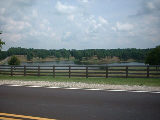 days, this one was also filled with trees and lakes and rivers, water
and I've seen
days, this one was also filled with trees and lakes and rivers, water
and I've seen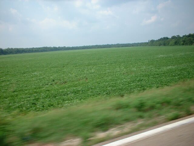 trees enough to believe the entire world is green. I guess it would be
possible to get tired of this kind of beauty, but to me it would take a really
long time. I expected to see a lot more horses as I passed through here, but I
must not have been on the right roads. We were supposed to take the 40 for most
of the trip, but the road was bad, under construction, and jammed. We decided
instead to try to parallel the 40, but there was not a good road for that, so we
kind of zigzagged through this part of the trip. It took a little longer, but it
was a much nicer trip. I saw a sign that said Millington
Navel Air Station and remembered back
about 30 years to a time I was stationed there. I just turned and completely
bypassed the city of Memphis. I got a chance to see the base again, but the city
was different and the base was under heavy guard. Even the clouds were odd for
the town. As we drove around the edge of Memphis and over the mighty
Mississippi river, we took a last look at a couple of the more famous buildings
and the bridge. Once we were in Arkansas again, we shed our helmets and drove
into a fantastic sunset until it got dark, then we found a place to stay.
And another beautiful day comes to an end.
trees enough to believe the entire world is green. I guess it would be
possible to get tired of this kind of beauty, but to me it would take a really
long time. I expected to see a lot more horses as I passed through here, but I
must not have been on the right roads. We were supposed to take the 40 for most
of the trip, but the road was bad, under construction, and jammed. We decided
instead to try to parallel the 40, but there was not a good road for that, so we
kind of zigzagged through this part of the trip. It took a little longer, but it
was a much nicer trip. I saw a sign that said Millington
Navel Air Station and remembered back
about 30 years to a time I was stationed there. I just turned and completely
bypassed the city of Memphis. I got a chance to see the base again, but the city
was different and the base was under heavy guard. Even the clouds were odd for
the town. As we drove around the edge of Memphis and over the mighty
Mississippi river, we took a last look at a couple of the more famous buildings
and the bridge. Once we were in Arkansas again, we shed our helmets and drove
into a fantastic sunset until it got dark, then we found a place to stay.
And another beautiful day comes to an end.
Up
early again and on the road. We decide to wait until we get to Little Rock for
breakfast. We took the 70 today since it conveniently runs parallel to the 40
all the way to Little Rock. This ride is perfect, little traffic although we can
see all the trucks and heavy traffic just a couple miles away. We drive
through several towns and stop for gas once, but this gives us a chance to chat
with the locals. It occurs to me that almost everywhere we go, when the locals find
out we came from California, their comments are along the line of, " I used
to live there." or "My brother, cousin, sister, friend, etc.
did." I think all the people in this country must have left
California, so I don't know why there are so many people there. 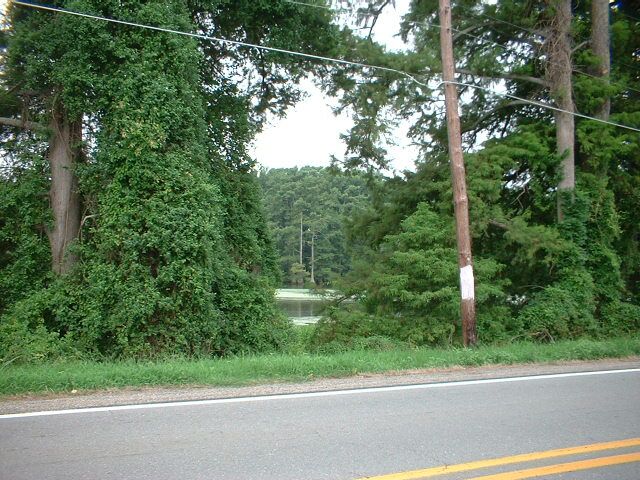 Perhaps
Americans just think it is the end all place until they live there a while, then
they realize it is just a place to pass some time before moving to where you
really want to live.. As we pass the
farms, fish hatcheries, and swamps, we finally get to North Little Rock. Just
try to find a restaurant that serves breakfast at noon. We finally found a
Waffle House and get fed. As we leave Little Rock and head west, we decide to
take the 65 north to check out the Ozarks one more time. Karen likes it here and
I couldn't resist one last look before we head back. We get another of
those sudden downpour's but this time I see it coming and we have a chance to
get out of it by stopping at one of those Flea Markets. Then Karen sees this
sign that there is a "natural bridge" and decides to
Perhaps
Americans just think it is the end all place until they live there a while, then
they realize it is just a place to pass some time before moving to where you
really want to live.. As we pass the
farms, fish hatcheries, and swamps, we finally get to North Little Rock. Just
try to find a restaurant that serves breakfast at noon. We finally found a
Waffle House and get fed. As we leave Little Rock and head west, we decide to
take the 65 north to check out the Ozarks one more time. Karen likes it here and
I couldn't resist one last look before we head back. We get another of
those sudden downpour's but this time I see it coming and we have a chance to
get out of it by stopping at one of those Flea Markets. Then Karen sees this
sign that there is a "natural bridge" and decides to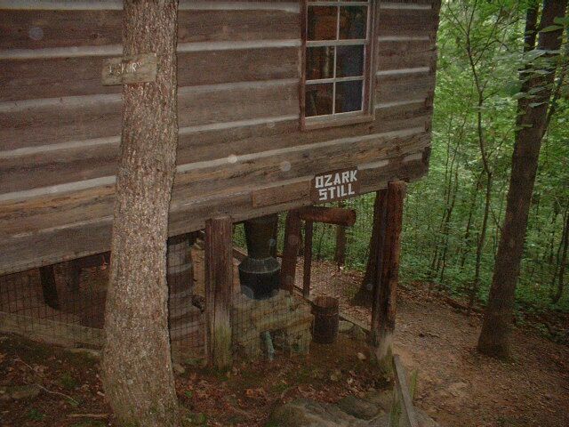 check it
out. She gets a little surprise when she has to descend about 1000 feet in
a sharp switchback type road in about a half mile of distance. Still we got to
see an old moonshine still as well as the bridge. By the time we get
through the mountains, it is 7pm and we are in a little place called Eureka
Springs and Karen likes the town, so we decide to spend the night here. We
should be able to make Tulsa by noon tomorrow, and who knows from there. Time
will tell.
check it
out. She gets a little surprise when she has to descend about 1000 feet in
a sharp switchback type road in about a half mile of distance. Still we got to
see an old moonshine still as well as the bridge. By the time we get
through the mountains, it is 7pm and we are in a little place called Eureka
Springs and Karen likes the town, so we decide to spend the night here. We
should be able to make Tulsa by noon tomorrow, and who knows from there. Time
will tell.
We
were not able to get pictures of the town of Eureka Springs last night, so we
took several this morning.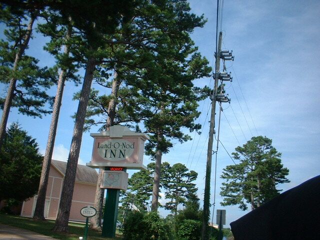 There are so many cute little places to stay
and eat, we had to save them for our scrapbook. As we got on the
road again, we found the "mountain roads" we have become so fond
of. After an hour or so of this gorgeous place, we crossed over into
Oklahoma. I am not exactly sure when, because we saw no sign announcing it.
I guess we were on a side road that was not important enough for a sign. The
first part of the ride in Oklahoma was very pleasant. The weather was
cooperating and the roads were in good shape. The trees started to thin a
little, but the rivers were still there. The wind started to pick up until we
realized that Mr. Wind was with us once more. We stayed mostly on side roads
again, and we were not disappointed. We took the interstate for about 10 miles
with the wind at our backs, but then we turned west once more for the ride into
Enid and the wind tried it's best to dissuade us. As we drove through Perry and
then Enid we found we were either on or crossing the old "Chisholm
Trail". The sign was in a rather poor location and I could only get one
picture as I passed the intersection. After checking in for the night, we went
out for dinner and saw another outstanding sunset. Then came the highlight of
our evening, Applebee's. I was surprised, not at the place itself, which
was nicely decorated with references to the hometown heroes that made it into
the spotlight, but at the real heroes that are still working here. We had an
opportunity to talk with a very pretty girl named Bethany. Please forgive me if
I misspelled. She made us feel as if we were
There are so many cute little places to stay
and eat, we had to save them for our scrapbook. As we got on the
road again, we found the "mountain roads" we have become so fond
of. After an hour or so of this gorgeous place, we crossed over into
Oklahoma. I am not exactly sure when, because we saw no sign announcing it.
I guess we were on a side road that was not important enough for a sign. The
first part of the ride in Oklahoma was very pleasant. The weather was
cooperating and the roads were in good shape. The trees started to thin a
little, but the rivers were still there. The wind started to pick up until we
realized that Mr. Wind was with us once more. We stayed mostly on side roads
again, and we were not disappointed. We took the interstate for about 10 miles
with the wind at our backs, but then we turned west once more for the ride into
Enid and the wind tried it's best to dissuade us. As we drove through Perry and
then Enid we found we were either on or crossing the old "Chisholm
Trail". The sign was in a rather poor location and I could only get one
picture as I passed the intersection. After checking in for the night, we went
out for dinner and saw another outstanding sunset. Then came the highlight of
our evening, Applebee's. I was surprised, not at the place itself, which
was nicely decorated with references to the hometown heroes that made it into
the spotlight, but at the real heroes that are still working here. We had an
opportunity to talk with a very pretty girl named Bethany. Please forgive me if
I misspelled. She made us feel as if we were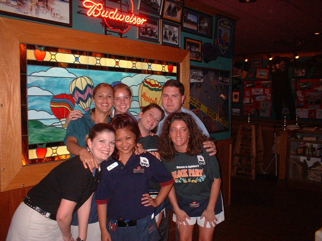 regulars and suggested a couple of
items on the menu that I found delightful. The music was good and the atmosphere
was happy. We ask if she would have all the employees get together for picture
and they obliged. Good food in a good environment with great company is about
the best you can ask for. I walked out hoping to get a chance to see them
again one day. Well that's about it for day 30. Tomorrow we should make Texas.
It looks like maybe Amarillo.
regulars and suggested a couple of
items on the menu that I found delightful. The music was good and the atmosphere
was happy. We ask if she would have all the employees get together for picture
and they obliged. Good food in a good environment with great company is about
the best you can ask for. I walked out hoping to get a chance to see them
again one day. Well that's about it for day 30. Tomorrow we should make Texas.
It looks like maybe Amarillo.
Today
started out a little chilly because it rained quite a bit overnight and every
thing was wet. It was a reasonably easy ride to the Texas
boarder, but it was
pretty barren to. When we got there, we thought we'd get a picture of the Oklahoma
sign on the other side of the road, but again there was none. Across 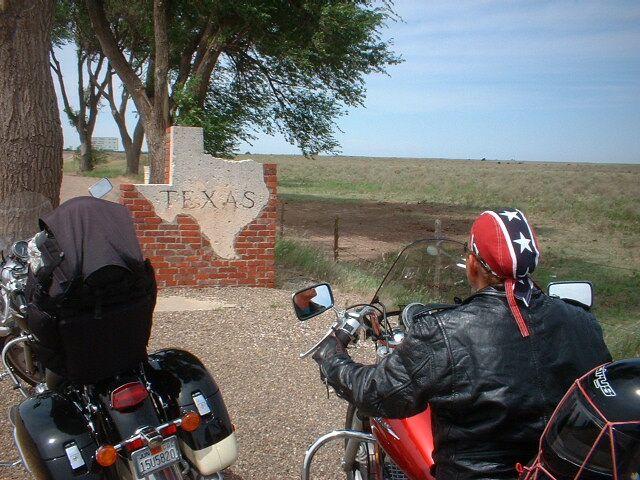 to
the Texas side we found out what barren really was. There were no trees
to
the Texas side we found out what barren really was. There were no trees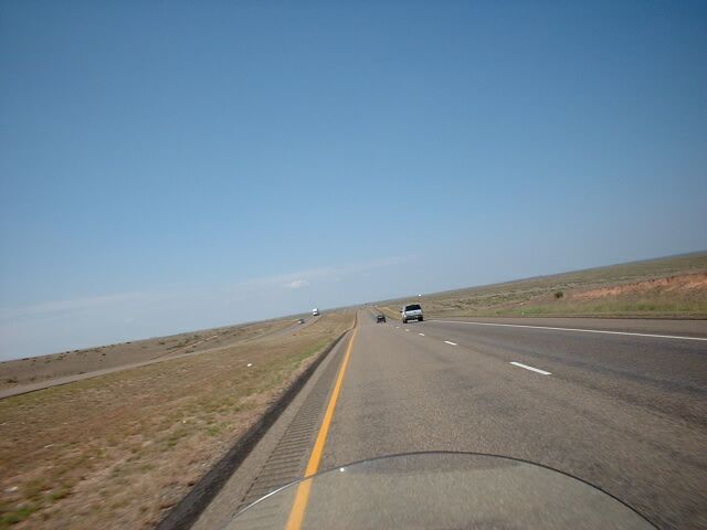 anywhere. If it had been raining on this road, we would just have gotten soaked.
As we rounded the bend in Amarillo and headed for Dumas for the last stretch of today's
ride, we actually found a road that had even less to look at. Even the sage brush and weeds
were missing. Tomorrow we will head for New Mexico and hopefully some
scenery of some kind.
anywhere. If it had been raining on this road, we would just have gotten soaked.
As we rounded the bend in Amarillo and headed for Dumas for the last stretch of today's
ride, we actually found a road that had even less to look at. Even the sage brush and weeds
were missing. Tomorrow we will head for New Mexico and hopefully some
scenery of some kind.
Leaving
Dumas, Texas and heading west, there was not much of note except the vapor
trails in the sky. It is amazing to be able to look at these and be able to tell
the difference between the military and civilian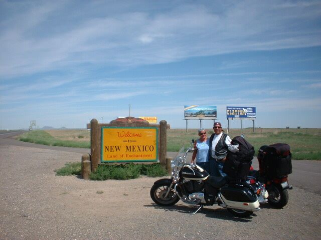 planes that made these. We
crossed into New Mexico and it wasn't very long before we started to see some
changes in the distance. Landscape started growing a few more trees and bushes
and rocks started to appear. Then hills and mountains, then animals and
people. I took some pictures of deer I saw alongside the road, but I guess
they were too far away to show in the pictures. We had a chance to ride along
the Cimarron and Santa Fe Trails and see some of the remnants of a time long gone. At one
point we stopped for a break and we came across a wild turkey. It must have been
30 pounds or more and when I got close it actually flew over the creek better
than 30 feet. I was totally surprised it could lift from the
planes that made these. We
crossed into New Mexico and it wasn't very long before we started to see some
changes in the distance. Landscape started growing a few more trees and bushes
and rocks started to appear. Then hills and mountains, then animals and
people. I took some pictures of deer I saw alongside the road, but I guess
they were too far away to show in the pictures. We had a chance to ride along
the Cimarron and Santa Fe Trails and see some of the remnants of a time long gone. At one
point we stopped for a break and we came across a wild turkey. It must have been
30 pounds or more and when I got close it actually flew over the creek better
than 30 feet. I was totally surprised it could lift from the 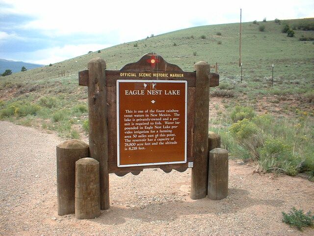 ground. As we
rode up to Eagle Nest Lake, we saw some of the most beautiful clouds until we
realized they were full of water and in our path. Sure enough about 10 miles
from Taos, it dumped on us. We got wet, but not too long and we dried
quickly. The only bad part was the last 3 miles or so was a gravel road that was
very wet. Once we got into town, it stopped. A little later the clouds
were black in one direction and sky blue a few degrees away. At least we are
inside and hopefully the weather will be better tomorrow.
ground. As we
rode up to Eagle Nest Lake, we saw some of the most beautiful clouds until we
realized they were full of water and in our path. Sure enough about 10 miles
from Taos, it dumped on us. We got wet, but not too long and we dried
quickly. The only bad part was the last 3 miles or so was a gravel road that was
very wet. Once we got into town, it stopped. A little later the clouds
were black in one direction and sky blue a few degrees away. At least we are
inside and hopefully the weather will be better tomorrow.
We
left Taos, New Mexico about 8:30 am and headed toward home again. This was one of those
mountain cold mornings. It was cold, but the air was so clean you just wanted to
breathe it in. As we rounded the town and headed south, we were crossing
the Rio Grande River before I even knew it was there. I did get a picture from
the bridge and then we turned west. We passed several dozen houses that
were partially buried in the ground and covered with solar panels. The
interesting thing about these houses was that none of the telephone and power
poles on the road went anywhere near the houses. I think they were completely solar powered. A few miles down the road and there were
llamas in the
field 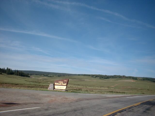 as it they were the most natural thing around. Not too much farther the
desert gave way to the Carson National Forest and some fantastic fishing and
hunting areas based on what I've heard. Not only did we see the typical
horses and cattle, but I saw a cow elk and half a dozen wild turkeys roaming the
road. As we topped the mountain I thought I had found a cow and calf that
had gotten out, but rounding the bend, we found that they were all out. I guess
they just wanted to see the view from the top, which can only be
as it they were the most natural thing around. Not too much farther the
desert gave way to the Carson National Forest and some fantastic fishing and
hunting areas based on what I've heard. Not only did we see the typical
horses and cattle, but I saw a cow elk and half a dozen wild turkeys roaming the
road. As we topped the mountain I thought I had found a cow and calf that
had gotten out, but rounding the bend, we found that they were all out. I guess
they just wanted to see the view from the top, which can only be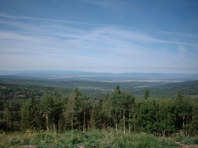 described as
breathtaking. We met some real nice folks that were touring from Missouri
several miles back and they arrived here as we were leaving. It was just one of
those views you can't pass up. As we started down the mountain, I had to
pull off and get a good picture of the 20,000.0 on my odometer. It
actually has 24,000 on it but the odometer had been replaced at 4000 miles. We
passed some beautiful ranches up here that almost made me want to give it up and
move here. Well until I remembered how much work it was on my grandfathers ranch
when I was younger. I can't believe how fast the terrain out here changes. One
minute desert, then trees, then rocks, then shrubs, then plains, then back to
desert. We finally crossed into Arizona and made a short detour to four
described as
breathtaking. We met some real nice folks that were touring from Missouri
several miles back and they arrived here as we were leaving. It was just one of
those views you can't pass up. As we started down the mountain, I had to
pull off and get a good picture of the 20,000.0 on my odometer. It
actually has 24,000 on it but the odometer had been replaced at 4000 miles. We
passed some beautiful ranches up here that almost made me want to give it up and
move here. Well until I remembered how much work it was on my grandfathers ranch
when I was younger. I can't believe how fast the terrain out here changes. One
minute desert, then trees, then rocks, then shrubs, then plains, then back to
desert. We finally crossed into Arizona and made a short detour to four
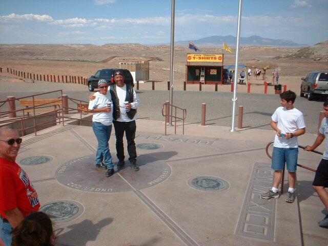 corners.
We just had to get one picture of us in all four states at once. Then we crossed
into Colorado to spend the night in Cortez. I remember when we crossed in from
the west side, it was so rich and colorful, but from the south, nothing. There was no grass, no shrubs, not even any sand. I've never seen any
place so barren. Well, there were several thousand Coors beer bottles along the
highway, but not much else. As we got closer to Cortez, we noticed smoke
over the mountain. It got worse as we got closer until in Cortez, the entire sky
from our room was grayed out. A couple hours later it made for quite a
sunset though. Well, tomorrow it is back to Arizona for another desert trip toward
home.
corners.
We just had to get one picture of us in all four states at once. Then we crossed
into Colorado to spend the night in Cortez. I remember when we crossed in from
the west side, it was so rich and colorful, but from the south, nothing. There was no grass, no shrubs, not even any sand. I've never seen any
place so barren. Well, there were several thousand Coors beer bottles along the
highway, but not much else. As we got closer to Cortez, we noticed smoke
over the mountain. It got worse as we got closer until in Cortez, the entire sky
from our room was grayed out. A couple hours later it made for quite a
sunset though. Well, tomorrow it is back to Arizona for another desert trip toward
home.
As
we left Cortez, Colorado this morning there was hardly a sign of the fire from
the day before. The sky was clear and the smell was all but gone. There
was the telltale sign of ashes on the cars, but we were not driving a car. We
headed south backtracking for the first few miles, then headed straight to Gallup,
New Mexico. For the amateur, this part of the country might seem like boring
and lifeless, but to the professional traveler you can see signs of life
everywhere. Besides the rock formations and creations, we saw eagles, elk, cougar
and snakes. Why we even saw some dinosaurs. I guess you just have to know where
to look. We took highway 40 from Gallup to Flagstaff because it is the only road
that goes here. 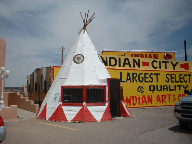 But as our luck would have it, as soon as we crossed the Arizona
line, there was the road construction we have become used to on this road.
Still we did get to see an authentic Indian Jail and lots of
But as our luck would have it, as soon as we crossed the Arizona
line, there was the road construction we have become used to on this road.
Still we did get to see an authentic Indian Jail and lots of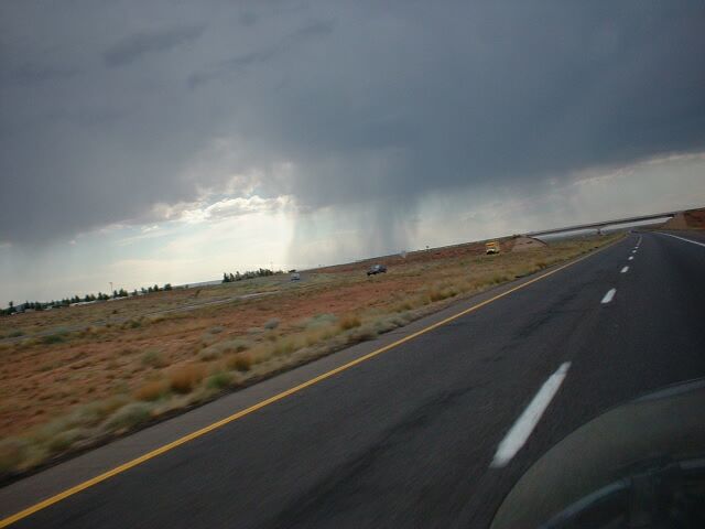 Teepee's. Heck we
even found water. And then more water, and then the sky opened up and showed us
where it comes from. After seeing just how much rain you can ride in
before you just can no longer see to ride, we stopped, dressed appropriately,
and went on. There was no place to get out of it anyway, so we just rode through
it. At least we were not the only ones, two other bikers stopped with us to
rearrange clothing before going on. Well about five miles before Flagstaff it
stopped. By the time we found our motel, we were all but dry. The sky was
telling a different story though, so I took a few pictures, then we went inside
and watched from a dry spot. We went across the street for dinner and when we
came out, the sky was blue. Well we are hoping it will be gone by morning because
we have another long ride ahead of us
Teepee's. Heck we
even found water. And then more water, and then the sky opened up and showed us
where it comes from. After seeing just how much rain you can ride in
before you just can no longer see to ride, we stopped, dressed appropriately,
and went on. There was no place to get out of it anyway, so we just rode through
it. At least we were not the only ones, two other bikers stopped with us to
rearrange clothing before going on. Well about five miles before Flagstaff it
stopped. By the time we found our motel, we were all but dry. The sky was
telling a different story though, so I took a few pictures, then we went inside
and watched from a dry spot. We went across the street for dinner and when we
came out, the sky was blue. Well we are hoping it will be gone by morning because
we have another long ride ahead of us
We
left a little later than we intended this morning because it was raining. We
waited until it slowed down and then took our shot. We got a little rain in
several places for the first 100 miles or so, but never enough to get wet. 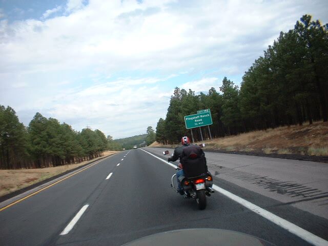 I
actually wore my jacket for the second time on this trip. I had no idea that
Flagstaff was so high in the mountains. The town looks like it was built around
the trees instead of clearing them. One more surprise for me. I guess it is one
of those things we do when we think of a town without having been there, we just
picture it the way we think it is. We saw our first sign indicating Los Angeles
was within driving distance. I guess home is really coming up. We made real good
time all the way to Kingman, but then the sun came out and it started getting
hot. Up until then we had some beautiful and ever changing scenery. We even got
a chance to see 2 bulls posturing at each other across a road. I never saw an
animal kick up so much dirt just to get another animals attention. Karen's bike
went over 15,000 miles so I guess it is not new anymore. We were
considering riding a long day and trying to make it home tonight, but it just
got too hot. My guess is that by time we got to Havasu City, it was well over
100. It was so hot that we couldn't drive. The heat coming off the road
and from the sky is hotter than the heat from the motor. We decide to hold up
here and leave early in the morning before the sun can get started.
I
actually wore my jacket for the second time on this trip. I had no idea that
Flagstaff was so high in the mountains. The town looks like it was built around
the trees instead of clearing them. One more surprise for me. I guess it is one
of those things we do when we think of a town without having been there, we just
picture it the way we think it is. We saw our first sign indicating Los Angeles
was within driving distance. I guess home is really coming up. We made real good
time all the way to Kingman, but then the sun came out and it started getting
hot. Up until then we had some beautiful and ever changing scenery. We even got
a chance to see 2 bulls posturing at each other across a road. I never saw an
animal kick up so much dirt just to get another animals attention. Karen's bike
went over 15,000 miles so I guess it is not new anymore. We were
considering riding a long day and trying to make it home tonight, but it just
got too hot. My guess is that by time we got to Havasu City, it was well over
100. It was so hot that we couldn't drive. The heat coming off the road
and from the sky is hotter than the heat from the motor. We decide to hold up
here and leave early in the morning before the sun can get started.
We
got an early start this morning. 5 am we were on the road. Morning light was
just bright enough to see the road. The parking lots were all packed with cars
and trucks hooked up to boats, but the streets were quiet. We left town
without anyone even noticing. The ride from Lake Havasu City to Parker was 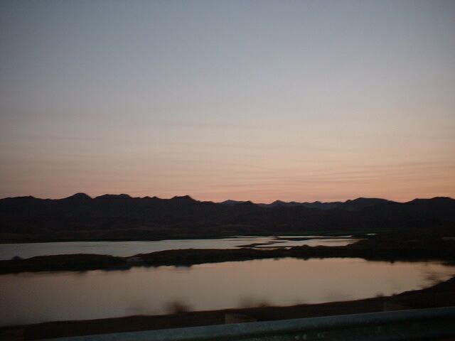 one
of the best we have seen. Well at least at that time in the morning. I
tried to take some pictures, but what I saw and what the camera saw are not
quite the same. Still they are interesting, and it is difficult to make a
sunrise look different from a sunset. It was already 82 when we woke up. Once we
crossed the river into California, the sun was already up. We set our noses to
the west and hit the gas. Another 100 miles or so of desert and we managed to
get to 29 Palms about 8 am, had breakfast and hit the road again. We saw
some of those smoky clouds again so I guess something is still on fire in good
old southern California. A little further down the road and the familiar
one
of the best we have seen. Well at least at that time in the morning. I
tried to take some pictures, but what I saw and what the camera saw are not
quite the same. Still they are interesting, and it is difficult to make a
sunrise look different from a sunset. It was already 82 when we woke up. Once we
crossed the river into California, the sun was already up. We set our noses to
the west and hit the gas. Another 100 miles or so of desert and we managed to
get to 29 Palms about 8 am, had breakfast and hit the road again. We saw
some of those smoky clouds again so I guess something is still on fire in good
old southern California. A little further down the road and the familiar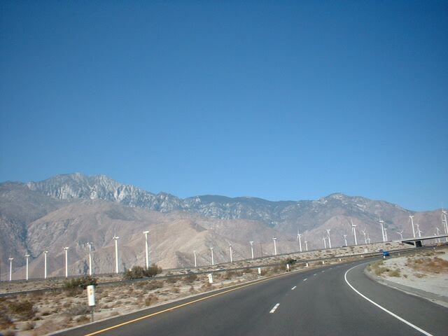 windmills north of Palm Springs appear. We know we are getting close to
home. I think those things multiply by themselves, because every time I find
so many more than we could have put up. They look like an army being put in the
field for military exercises. As we turn onto the 91 and look into the valley we
call home, a reminder of the quality of the air we have here stares us in
the face. That thing we call smog is just too ever-present. Well we pull the
bikes into the garage and as we let them cool down, I note that our mileage is
just under 10,000 miles more than the last time we were here. 9648.2 to be
exact. Well I guess I'll have to get them to the shop for their well baby checks
again. Until next time, we'll see you on the By-Ways....
windmills north of Palm Springs appear. We know we are getting close to
home. I think those things multiply by themselves, because every time I find
so many more than we could have put up. They look like an army being put in the
field for military exercises. As we turn onto the 91 and look into the valley we
call home, a reminder of the quality of the air we have here stares us in
the face. That thing we call smog is just too ever-present. Well we pull the
bikes into the garage and as we let them cool down, I note that our mileage is
just under 10,000 miles more than the last time we were here. 9648.2 to be
exact. Well I guess I'll have to get them to the shop for their well baby checks
again. Until next time, we'll see you on the By-Ways....
************************************************************************
.
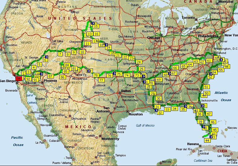